Dr. Michael Durand's NASA funded SnowEx Fieldwork in Alaska

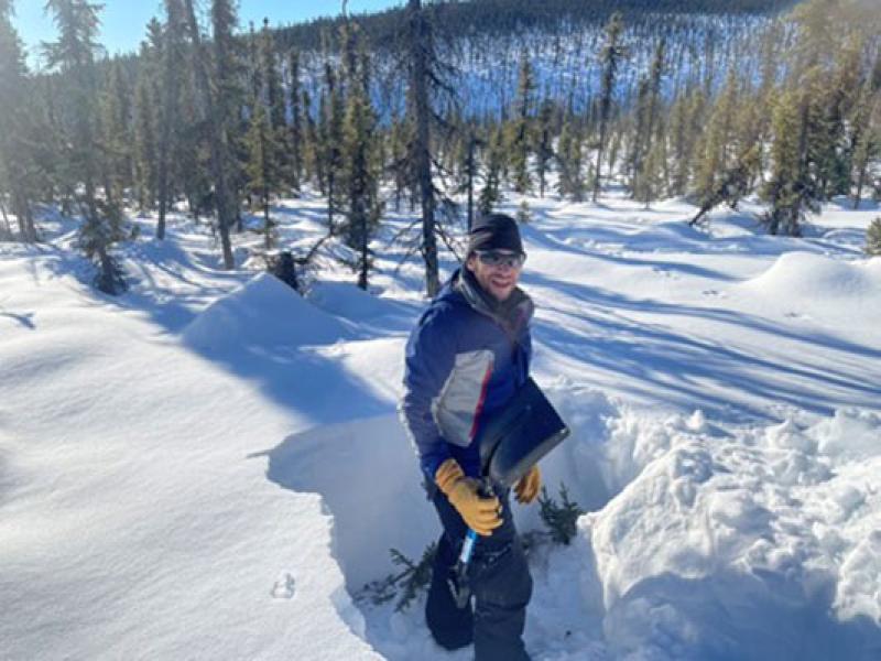
A snowpit on the Alaska Coastal plain. Clockwise from bottom: Kelly Elder makes snow measurements in a snowpit in a drift near the edge of a frozen lake. Art Gelvin prepares to make snow depth measurements along a transect several hundred meters in length. Durand records snowpit notes.
In March, Prof. Michael Durand traveled to Alaska for snow fieldwork. He joined a group of a dozen researchers from around the country, for a scouting trip to support a much larger community field campaign in Alaska to take place Fall 2022 and Winter 2023, part of the SnowEx series of field, aircraft and spaceborne remote sensing experiments.
SnowEx field campaigns are part of NASA’s ongoing support of field campaigns to support development of possible future spaceborne missions to measure snow for the entire planet. Current satellites can see whether snow is present on the ground, but not how deep it is. Snow is a critical water resource for the United States and globally that is at risk from warming temperatures. A series of satellite missions have been proposed but ultimately not selected for launch, including missions proposed by the European Space Agency, and the Chinese Space Agency. To succeed where others have failed, SnowEx is focusing on exhaustive ground validation of airborne versions of multiple satellite sensors.
The team spent six days in Fairbanks, visiting multiple long-term research sites, and testing data collection protocols for the following year. The team then drove five hundred miles north up the Dalton Highway, to Prudhoe Bay, and had the chance to compare the snow on the Alaska Coastal Plain. Here, in the tundra biome, trees cannot grow due to harsh conditions. The wind is unimpeded by trees, and creates ultra-hard wind slab, underlain by vertical chains of massive depth hoar crystals.
Highlights for Durand were seeing the type of snow that evolves in tundra environments, seeing the Arctic in winter, learning more about trees that make up the Taiga, and seeing the Yukon River for the first time, which drains an enormous part (~850,000 km2) of the North American continent. And of course, the chance to participate in efforts to support a future snow mission, as well as the next generation of snow scientists!
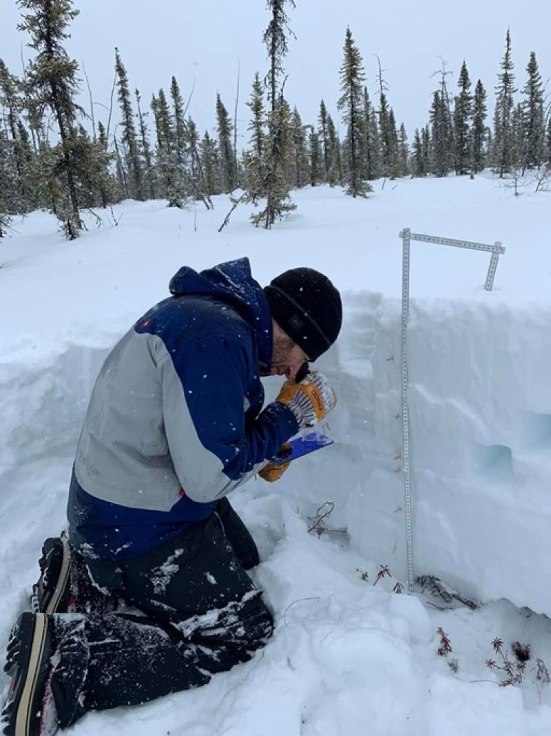
Durand measuring snow grain size using a hand lens and a crystal card at Bonanza Creek Experimental Forest. Photo credit: HP Marshall.
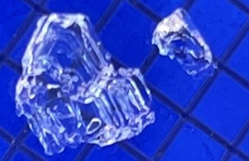
Photographs of depth hoar snow crystals from a snowpit at Caribou Poker Creek Research Watershed; photo credit: Michael Durand. A 2 mm grid is visible behind the crystals.