A new climatology of North American mountain snow from regional climate model simulations
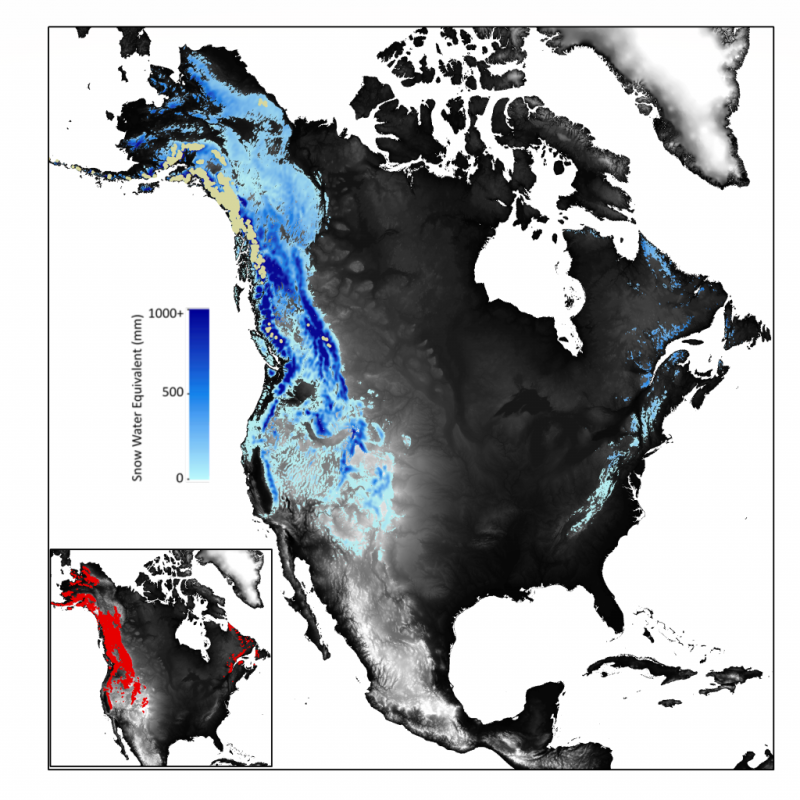
We created a new climatological estimate of North American mountain snow using the Weather Research and Forecasting (WRF) regional climate model. Instead of a traditional 30-year climatology of snow water equivalent (SWE) for the entire continent, we created representative climatologies for each individual mountain range. That is, we only simulate conditions for each mountain range for a single, average water year. This method decreases both the computational and data storage requirements while still approximating the long-term average conditions. The WRF SWE daily time series for each mountain range are available at NSIDC. Gridded SWE, latitude, longitude, and a mountain mask are included in each netCDF file. For further information, please see the corresponding paper in GRL.
This dataset forms a major part of student Melissa Wrzesien’s PhD thesis (March 2018).