Land Use and Land Cover Classification Results for India, January 2022
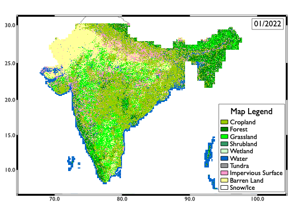
Description: We trained our deep learning model, which is the combination of HRNetV2 backbone and an FCN segmentation head, by using Norway's International Climate and Forest Initiative (NICFI) monthly basemaps and Finer Resolution Observation and Monitoring – Global Land Cover (FROM-GLC10). Then, we applied our deep learning model on other NICFI monthly basemaps to get recent land use and land cover results. Here is one month's result. The research is sponsored by USAID India forest sustainability project (Cooperative Agreement 72938621CA00002) and NSF/ NSF/Partnership for Innovation-Technology Transfer (PFI-TT), NSF2044704.
Image courtesy of Ying Zuo, School of Earth Sciences, The Ohio State University