Patagonia Ice Fields Vulnerable to El Niño Events, Byrd Center Researchers Find
Demián Gómez, Assistant Professor at The Ohio State University School of Earth Sciences (SES) and researcher at the Byrd Center, recently co-authored a report published in the journal Scientific Reports, titled Transient Ice Loss in the Patagonia Icefields during the 2015–2016 El Niño Event.
Image credit: Juan Pablo Parola
Straddling the border of Chile and Argentina, the Patagonia Icefields (PIF) are the largest glaciers of the southern hemisphere outside of Antarctica, covering an area equivalent to about one tenth of Ohio. The PIF have been melting rapidly, losing an equivalent of Lake Eerie in water over the past 15 years due to increasing ocean and air temperatures. Being close to the southern Pacific Ocean, climate conditions at the PIF are very sensitive to the oscillations in ocean and wind conditions commonly referred to as El Niño, and it’s thought that long term warming has left the PIF more vulnerable to such oscillations, resulting in major ice loss events. This impact, however, isn’t well understood and is not included in prediction of future ice loss and rates of sea-level rise.
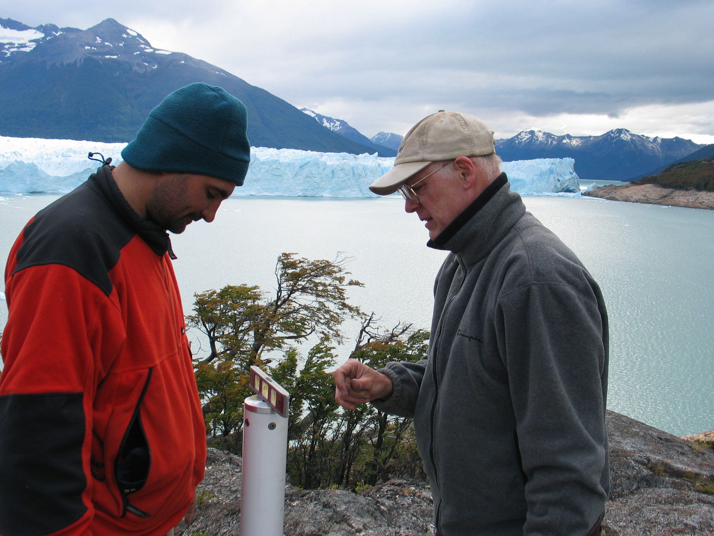
GPS installation field campaign in the Patagonia Icefields (Glaciar Perito Moreno), February 2010 Left to right: Sebastián Marinsek, Instituto Antártico Argentino and Robert Smalley, Jr. Center for Earthquake Research and Information, the University of Memphis, PIF Project PI. Image Credit: Robert Smalley, Jr.
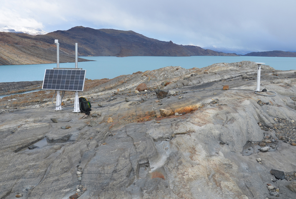
GPS station in Glaciar Upsala, GPS installation field campaign in the Patagonia Icefields (Glaciar Upsala), February 2010. Image Credit: Robert Smalley, Jr.
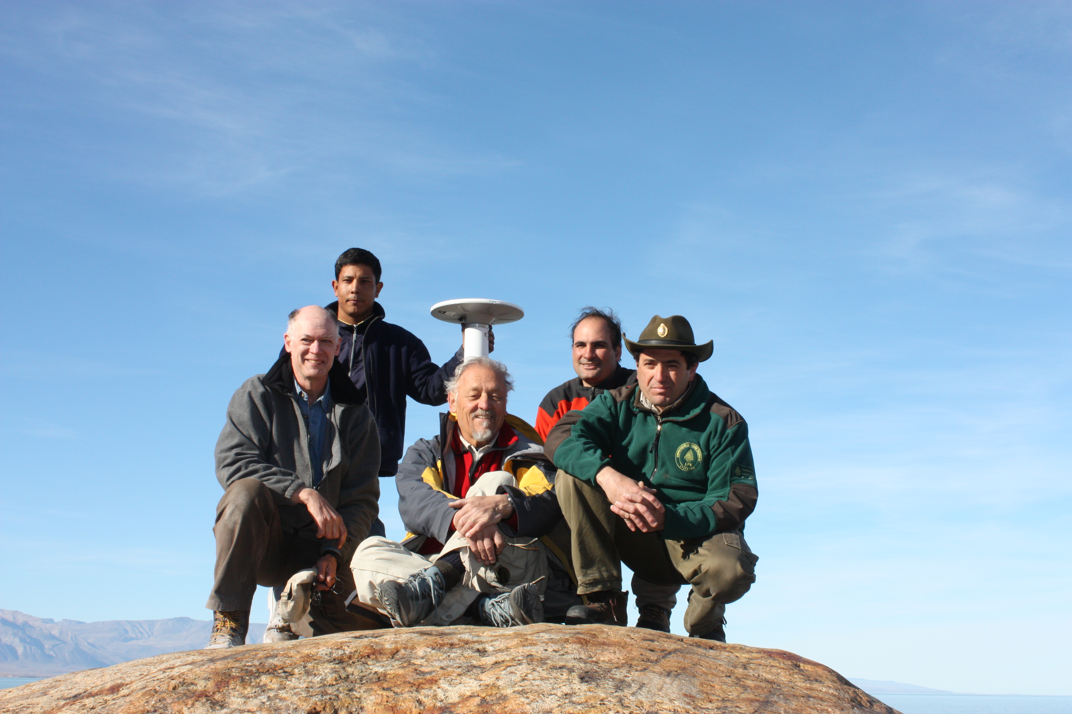
GPS installation field campaign in the Patagonia Icefields (Glaciar Upsala), February 2010 Left to right: Hernán Mamani, Instituto Geográfico Nacional Argentina, Robert Smalley, Jr. PIF Project PI, Center for Earthquake Research and Information, The University of Memphis, Pedro Skvarca, Instituto Antártico Argentino, Sebastián Marinsek, Instituto Antártico Argentino, Carlos Zoratti, Administración de Parques Nacionales, Argentina. Image Credit: Robert Smalley, Jr.
To measure the impact of El Niño on the PIF, Ohio State University School of Earth Sciences Assistant Professor and Byrd Center researcher Demián Gómez used a combination of Global Positioning System (GPS) and satellite data to isolate the ice loss at the PIF associated with a strong El Niño that started in 2015 from the longer-term trends. He and his team found that the PIF lost a total of 40 Gigatons of ice in about 6 months, equivalent to the volume of ~70,000 football stadiums, the largest observed ice loss event in the PIF to date. During the first three months of 2016 the equivalent of 7 years of ice was removed in the northern PIF compared to the average yearly ice loss rate there over the last decade. These results confirm that PIF are becoming increasingly vulnerable to El Niño as the climate warms, with the potential for larger, rapid pulses of ice loss if El Niño increases in strength. Professor Gómez’s goal is to provide more detailed observation of ice loss in Patagonia to better understand the effects of El Niño and La Niña and improve predictions of sea-level rise.