Improving Forest Sustainability in Pan-India
Last month, Ying Zuo, a graduate student in the School of Earth Sciences (SES) at The Ohio State University, presented a research poster at the American Geophysical Union’s (AGU’s) annual meeting in Chicago, IL. She is the lead author on a project aiming to help improve India’s forest sustainability through a land use monitoring system provided by Norway’s International Climate and Forests Initiative (NICFI), an enterprise of the Norwegian government. This system is trained using high-resolution images of tropical forests from PlanetScope, a constellation of satellites imaging the globe.
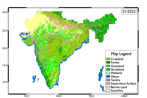
Using a deep learning model, Zuo and her colleagues combined datasets from NICFI and the global land cover map produced by Tsinghua University to generate several basemaps of the area from January to October 2022. These real-time monthly land use and land cover basemaps help detect seasonal shifts across India and the effects of climate change on forests.
Co-authors on this project include Professor C.K Shum, SES Distinguished University Scholar and a principal investigator at the Byrd Center, as well as Rongjun Qin, Yuanyuan Jia, Guixiang Zhang, and Shengxi Gui, all researchers at Ohio State.
To learn more about using deep learning to monitor India’s disappearing forest cover, visit the Ohio State News site or AGU's site for the research poster.
Visit Land use and land cover classification results for India, January 2022 for a description of the image.
Image courtesy of Ying Zuo, School of Earth Sciences, The Ohio State University.