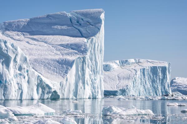
New High-Resolution Method Reveals Accelerated Ice Loss at Greenland's Margins
A new study published in Earth and Planetary Science Letters introduces a powerful technique to measure ice mass loss in Greenland with unprecedented spatial detail, particularly along the ice sheet's rapidly changing edges. Researchers led the study from multiple institutions, including Principal Investigator at the Byrd Polar and Climate Research Center and Professor and Ohio Eminent Scholar in the School of Earth Sciences at The Ohio State University, Michael Bevis.
The research team developed and applied a joint inversion method that integrates satellite data from NASA's Gravity Recovery and Climate Experiment (GRACE) with ground-based measurements from the Greenland Global Navigation Satellite System (GNSS) network. This hybrid approach enhances the resolution of ice mass change detection beyond the capabilities of either system alone, especially in low-elevation coastal zones where the most dynamic changes are occurring.
By incorporating vertical land movement data from 50 GNSS stations with gravity-based mass change observations from GRACE, the study offers a refined view of ice loss at a 0.25° grid scale—far more detailed than standard GRACE solutions. The method accounts for the complementary strengths of both datasets: GRACE's comprehensive coverage and GNSS's localized precision. To balance their contributions, the researchers introduced a new weight allocation strategy and tailored spatial constraints better to handle Greenland's irregular coastline and varying topography.
The study found that from 2008 to 2020, Greenland experienced an average ice loss rate of approximately 254 gigatons per year. Although slightly lower than estimates derived using GRACE data alone, the joint method revealed a significantly larger seasonal fluctuation in ice mass and uncovered substantial changes in localized glacier regions previously unresolved in satellite data. These findings offer a deeper understanding of how ice is moving and melting at the margins of the ice sheet, where discharge into the ocean directly contributes to sea level rise.
Importantly, the results confirm that regions near outlet glaciers are subject to more significant changes in ice mass than adjacent parts of the ice sheet. The study also highlighted how uncertainties in glacial isostatic adjustment (GIA) models can influence ice mass loss estimates by up to 20 gigatons per year, underscoring the importance of improved modeling in these assessments.
By combining high-resolution ground data with broad-scale satellite observations, this new method represents a significant advancement in cryospheric science. It provides a more nuanced understanding of the Greenland Ice Sheet's contribution to global sea level rise and supports efforts to refine predictive models of future change.
Learn about this study published in Earth and Planetary Science Letters.