Researchers Release Comprehensive Global Map of Shorelines and Intertidal Areas
A new global dataset offers detailed, high-resolution maps of coastlines and intertidal zones, compiled from over a decade of satellite imagery. Published in Scientific Data, the study was led by a team of researchers, including Ian Howat, Principal Investigator of the Glacier Dynamics Research Group at the Byrd Polar and Climate Research Center at The Ohio State University.
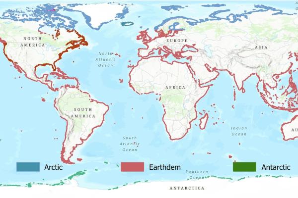
The dataset was developed using approximately 1.3 million images captured between 2009 and 2023 by WorldView-2 and WorldView-3 satellites. These multispectral images were analyzed to produce a 2-meter resolution map of global shorelines, representing the median tidal coastline at each location. The data also includes water probability maps and delineations of intertidal zones, coastal areas that are exposed or submerged depending on the tides.
In addition to mapping the coastlines themselves, the researchers identified areas particularly vulnerable to sea-level rise and coastal flooding. One of the most notable findings was the identification of the world’s largest mapped intertidal zone in south-central Alaska, measuring 124.7 square kilometers with a width of 3.8 kilometers.
To assess the accuracy of their results, the team compared their coastline products to two established datasets: the NOAA Continually Updated Shoreline Product (CUSP) and the Global Self-consistent, Hierarchical, High-resolution Shoreline (GSHHS) database. Their comparisons demonstrated improved spatial precision and highlighted the limitations of coarser-resolution shoreline products.
The study addresses a gap in the availability of global, fine-scale coastal data, offering a valuable resource for researchers, planners, and policymakers working on coastal management, climate adaptation, and environmental monitoring. The dataset is openly available through the NSF Arctic Data Center Repository.
By providing consistent, high-resolution coastal data, the study supports long-term efforts to understand and respond to dynamic changes in the world’s coastal zones.
Learn more about the study published in Scientific Data.