Using Satellite Altimetry Data to Monitor Groundwater Depletion Through Land Subsidence in California's Central Valley
Xuechen Yang, a graduate student in The School of Earth Sciences (SES) at The Ohio State University, is the lead author of a study using satellite altimetry data from California's Central Valley to measure the Earth's surface elevation change and monitor land subsidence. The primary cause of land subsidence, or sinking, is groundwater loss. In California, groundwater loss can mainly be attributed to climate change and excessive groundwater pumping for the large population, crop irrigation, agricultural use, and extensive drought periods.
Yang's co-authors include Professor C.K Shum, SES Distinguished University Scholar and a principal investigator at the Byrd Center and the principal investigator of the NASA Earth Surface and Interior Program (ESI), as well as Ting-Yi Yang of Polaris Geospatial Services, who initiated the research project.
Given the growing issue of water scarcity around the globe, the team hopes their research will help understand how the Earth's complex geophysical processes impact human life and identify solutions.
The research, titled Satellite Altimetry Applications on Land Subsidence, was presented at the annual meeting of the American Geophysical Union last month in Chicago, IL.
The NASA ESI Program and the Topcon Positioning System Inc. Fellowship supported the work.
Visit the Ohio State News site to learn more about Using satellites to track groundwater depletion in California.
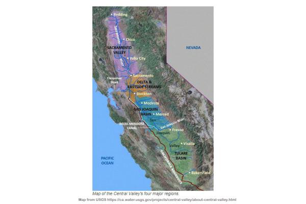
Credit: The image to the right is a United States Geological Survey (USGS) map of California's Central Valley.