Skip to main content
Skip to main content
The Ohio State University Byrd Polar and Climate Research Center
Show Links
Map
Buckeye Link
Webmail
Search Ohio State
Byrd Polar and Climate Research Center
About
Our Mission
Location, Hours and Parking
People
Research
Groups
Climate Analytics
Projects
Publications
People
Earth Systems Modeling
Projects
Publications
People
Education and Engagement
Projects
People
Contact Us
Environmental Geochemistry
Projects
Publications
People
Students
Alumni
Geological Sciences
People
Glacier Dynamics
People
Alumni
Publications
The Rapid Ice Sheet Change Observatory (RISCO) Initialization Program
Quantifying the Geophysical Causes of Present-Day Global Sea Level Rise
Constraining the causes, mechanisms and impacts of rapid changes in Greenland's outlet glaciers
Data and Software
GIMP 2000 Imagery Mosaic
GIMP Ice and Ocean Mask
GIMP Digital Elevation Model
GIMP Outlet Glacier Velocities
Links
Glacier Environmental Change
Research
Themes
Projects
Tracing cryo-hydro-social transformations in the tropical Andes
Publications
News
People
Collaborators
Ice Core Paleoclimatology
Our Mission
Projects
Publications
Available Data
Data Sets
Zenodo
github
Facilities
Ice Core Facility Renovation
News
Polar ENV: Polar and Environmental Geochemistry Lab
Research
Outreach
Publications
News
Contact
Polar Archives
Polar Geomicrobiology
Research
Current Research Projects
Past Research Projects
People
News
Publications
Polar Meteorology
Research
News
People
Polar Rock Repository
Polar Rock Repository Database
POLENET: The Polar Earth Observing Network
Remote Sensing
People
Publications
GISMO
Projects
Greenland
Jakobshavn
RAMP
Products
State Climate Office of Ohio
Measuring the Water Cycle
Join
News
People
Current Projects
Publications
Teaching
Datasets
A new climatology of North American mountain snow from regional climate model simulations
AirSWOT Data on the Willamette River
Example SWOT River Data Products
Facilities
Learning Center and Auditorium
Clean Room and Cold Labs
Cold Storage (Ice Core)
Goldthwait Polar Library
Ice Core Drilling
Machine Shop
Polar Archives
Sediment Core Repository and Lab
Polar Rock Repository
Polar Rock Repository Database
Virtual Rock Box
PRR News
Funding Opportunities and Information
Current Opportunities
Past Opportunities
Submission Guidance
Research Support Services
Awards and Scholarships
Goldthwait Polar Medal
The Byrd Postdoctoral Scholarship
Past Scholars
McKenzie-Brecher Undergraduate Scholarship
Rick Toracinta Graduate Scholarship
Henry Brecher Technical Achievement Award
Polar Archives Research Award
Lois M. Jones Award
Rae Mercier Award
Everett and Lay Service Award
Featured
News
Symposia
2019 | Women in Antarctica
Overview
Speakers
Mary R. Albert
Rosie Askin
Jessie L. Crain
Melisa A. Diaz
Kelly Falkner
Jill Ferris
Gretchen Hofmann
Liz Kauffman
Carol Landis
Amy Leventer
Lindsey McIntosh-Lin
Eileen R. McSaveney
Ellen Mosley-Thompson
Julie Mueller
Julie Palais
Claire Parkinson
Marilyn Raphael
Morgan Seag
Amelia Shevenell
Terry Tickhill Terrell
Pamela Theodotou
Karen R Tupek
Kathy Welch
Terry Wilson
Videos
2021 | NT4OP (New Tools for Old Problems)
2021 | WAMC/YOPP-SH (Year of Polar Prediction)
2022 | Climate Change Research at Ohio State
2023 | Symposium on Climate Change Research
Use Our Science
ArcticDEM | Arctic Elevation Change
FARM | Field Application Resource Monitor
FEVer | Fluid Earth Viewer
GRRATS | Global River Radar Altimetry Time Series
HYDRO | Ohio Hydrologic and Climate Assessment
REMA | Reference Elevation Model of Antarctica
Live Weather and Roof-top Camera
History Corner
Which Byrd expedition member hitch-hiked across America for a job interview?
Antarctic Snow Cruiser
Eunice Newton Foote: Climate Science Pioneer
First all-woman team in Antarctica
Flag Creator
Food and Dining of Antarctic Explorers
Henry Brecher
John H. Mercer: Alarmist or Visionary?
Women Need Not Apply
Opportunities for Students
Climathon
Solve Climate by 2030
Job and Volunteer Opportunities
Engage With Us
Attend Public Events and Tours
Customize Educational Visits and Center Tours
Video Gallery
Activities and Lessons
Newsletter
Giving
Support our Students
Support our Key Initiatives
Support our Research
Help the Planet
News & Events
News
Events
Search
Submit search
Toggle search dialog
Home
Upcoming Events
New Tools For Old Problems
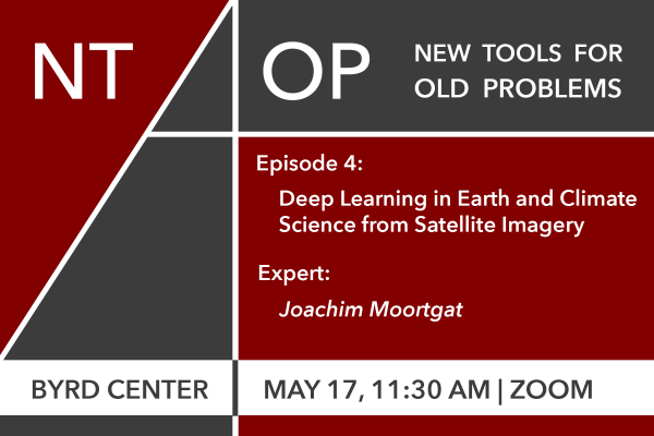
NT4OP | Deep Learning In Earth and Climate Science From Satellite Imagery
NT4OP | Deep Learning in Earth and Climate Science from Satellite Imagery
Mon, May 17, 2021
11:30 am - 12:30 pm
Zoom
Filed in:
Seminar