Indus Basin Water Project
Project Overview:
"If the wars of this century were fought over oil, the wars of the next century will be fought over water."
The Mershon Center for International Security Studies, in collaboration with the Byrd Polar and Climate Research Center, the Department of Geography, and the Department of History at Ohio State University, undertakes a unique investigation into the transboundary Indus Basin water conflict between Pakistan and India. This longstanding dispute is not only political but is also shaped by geography and exacerbated by climate change. As glaciers recede and rainfall patterns shift, the stakes surrounding water sharing become more critical.
The transboundary Indus River basin covers a vast area of 1.12 million km², distributed between Pakistan (47%), India (39%), China (8%), and Afghanistan (6%), and supports a population of approximately 268 million people. Despite the 1960 Indus Water Treaty (IWT), which successfully mediated tensions for decades, recent political rhetoric, lack of cooperation, and climatic disruptions raise uncertainties about the treaty's sustainability.
Project Conception and Team Formation:
The Mershon Project was conceived through discussions between Bryan Mark (Byrd Polar), Fazlul Haq (Byrd Postdoctoral Fellow from Pakistan), and the Mershon Center leadership. Their idea to examine the intersection of water diplomacy and ongoing cryo-climatic changes led to broader collaborations with Nicholas Breyfogle, an environmental historian, and Madhumita Dutta, a human geographer. This interdisciplinary team was formed to address the following key questions:
- How are contemporary cryo-hydro-climatic changes influencing the Indus Basin Water Conflict?
- Can the Indus Water Treaty adapt to the evolving dynamics of the region?
- What are the real issues behind the conflict, and how does political rhetoric influence them?
The project is generously supported by a Mershon Center catalyst funding Fazlul Haq (research scientist at Byrd) and Mansi Goyal (graduate student in History). The project team collaborates with researchers in Pakistan and India, including Ghani Rahman (University of Gujrat, Pakistan) and former Byrd research scientist Saurabh Vijay (India). Fieldwork in India and Pakistan will leverage Fazlul’s and Ghani’s networks in Pakistan and Madhu’s networks in India to ensure culturally sensitive and sustainable research.
Project Objectives:
The project seeks to provide a comprehensive and unbiased exploration of the complex relationship between transboundary water management, climate change, and political tensions. Key objectives include:
- Investigating cryo-hydrological changes in the Indus Basin and their effects on water availability and distribution.
- Examining how local communities in the basin are adapting to these changes.
- Analyzing how these physical and social transformations are influencing diplomatic processes and negotiations, with a focus on political rhetoric and geopolitics.
By placing these contemporary transformations into a long-term historical perspective, the project aims to build a holistic understanding of how climate change and water diplomacy intersect in the Indus Basin.
Importance of the Project:
The Indus Basin is one of the most water-stressed regions in the world. Over 300 million people depend on its waters, and the conflict over its distribution has significant implications for regional stability. As climate change disrupts water flows and intensifies disputes, understanding the roots and trajectories of these conflicts is crucial for formulating strategies to manage shared water resources peacefully. The findings from the Mershon Project will contribute not only to the theoretical understanding of transboundary water conflicts but also to water diplomacy efforts in other critical regions.
Past Workshops:
The project has already hosted two virtual international workshops, bringing together experts from India, Pakistan, and third-party scholars to discuss the multiple perspectives on the Indus Basin conflict. These workshops provided a platform for dialogue on the real nature of the conflict and the role of political narratives in shaping the discourse. A summary of these workshops will be available via the Indus Basin Water Project Events page.
Moving Forward:
In addition, the project is planning an in-person, week-long conference/workshop at an impartial venue, tentatively in Nepal, in May this year. This conference will invite academicians, scientists from various relevant disciplines, and former diplomatic experts. The primary aim of this gathering will be to foster Track III diplomacy between India and Pakistan, promoting dialogue and collaboration through non-official channels. By creating a neutral space for discussion, the project seeks to advance understanding and cooperation over shared water resources, and to contribute to long-term strategies for peaceful water-sharing agreements.
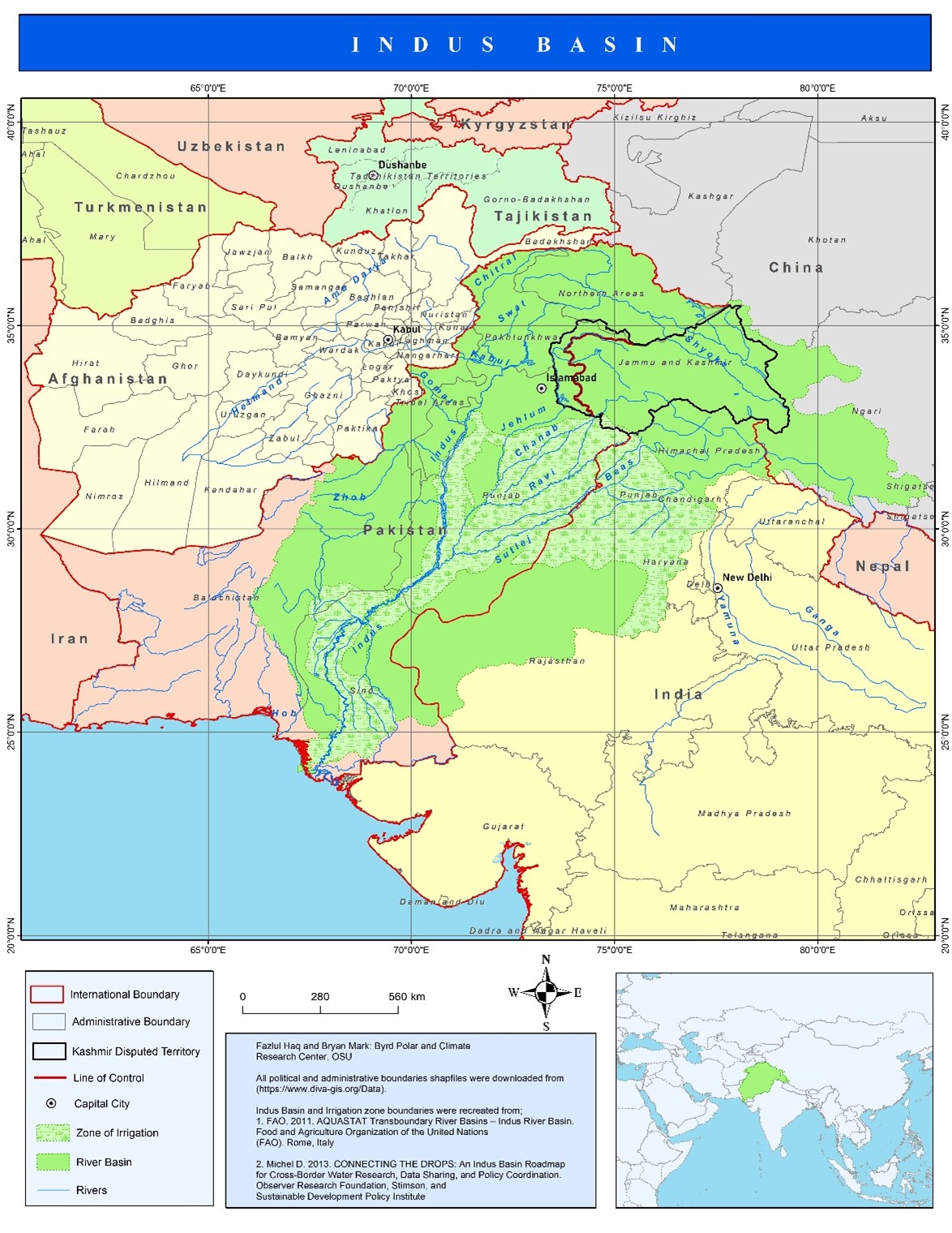
Map of the Indus Basin
This map illustrates the transboundary Indus River Basin, spanning across Pakistan, India, and parts of China and Afghanistan. The basin's vast network of rivers, irrigated zones, and political boundaries highlights the complexity of water management and sharing in the region
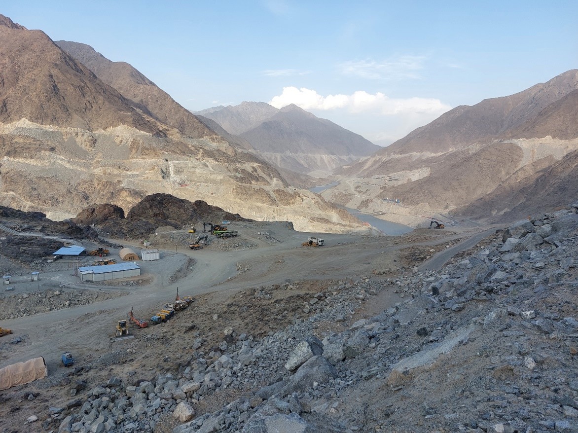
Diamer-Bhasha Dam Site, Indus River, Pakistan
This image captures the construction site of the Diamer-Bhasha Dam along the Indus River, set against the rugged mountain landscape of northern Pakistan. Taken in June 2022 by Fazlul Haq, the photo highlights the scale of this major infrastructure project, which is expected to significantly impact water management, energy production, and the surrounding environment in the region.
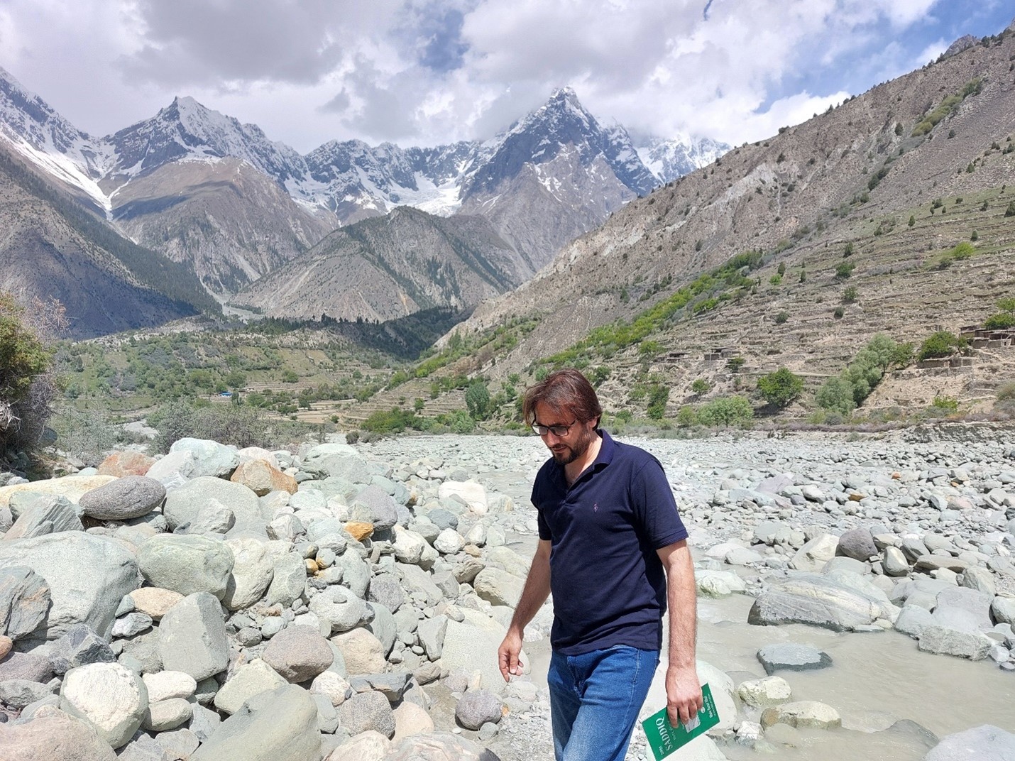
Gargo Glacier Floodplain, Upper Indus Basin, Pakistan
This image, taken in June 2022 by Fazlul Haq, shows the active flash flood area of the Gargo Glacier floodplain in the Upper Indus Basin. The region experiences frequent flooding caused by water surging from the glacier during glacial melt events. The floodplain is a critical zone for understanding the dynamics of glacial lake outburst floods (GLOFs) and their impacts on the Indus Basin hydrology. The towering Rakaposhi Peak (25,551 feet) in the background adds further context to the cryospheric influences shaping this environment.
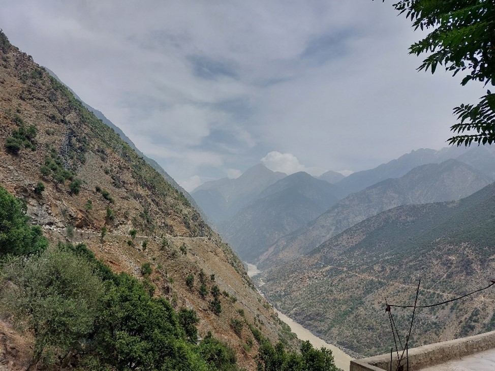
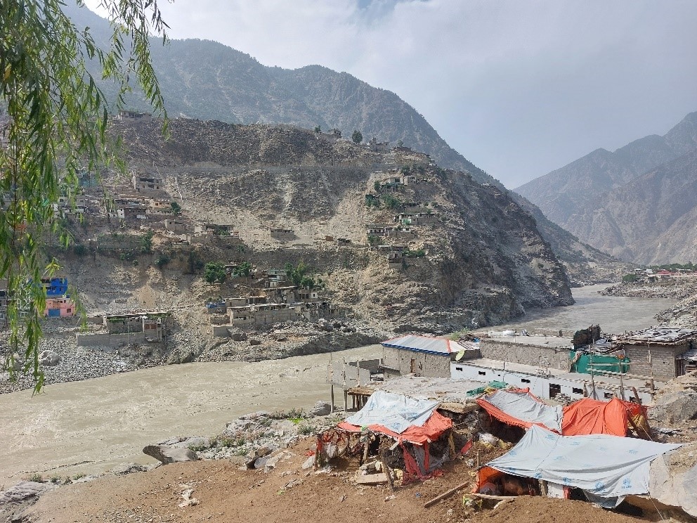
Indus Gorge, Upper Indus Basin, Pakistan
These images of the Indus Gorge highlight the steep, rugged landscape through which the Indus River flows in the Upper Indus Basin. The landscape is one of the major challenges in water management.
Previous Workshops Under The Mershon Project
As part of the Mershon Project on the Indus Basin Water Conflict, two virtual workshops were conducted to engage experts from various fields, including history, geopolitics, environmental science, and water diplomacy. These workshops provided an analysis of the conflict between India and Pakistan, focusing on the historical, climatic, geopolitical, and social dimensions shaping the region's water-sharing agreements
For questions, contact Fazlul Haq at haq.47@osu.edu.
Recent Interviews with Dr. Fazlul Haq, Researcher at the Byrd Polar and Climate Research Center:
- Kaiser, J. 2025. Climate change threatens India–Pakistan pact over major river system. Science, published 11 June 2025.
- Ansari, Sadiya, Contributor. 2025. Context newsletter, Thomson Reuters Foundation, published 19 May 2025.
