ICESat-2 Workshop

By Karina Peggau
On Tuesday June 11th, the Byrd Polar and Climate Research Center Glacier Dynamics group hosted an ICESat-2 workshop. ICESat-2, or Ice, Cloud, and Land Elevation Satellite-2, is responsible for carrying and powering the Advanced Topgraphic Laser Altimeter System (ATLAS), a high-resolution instrument used for measuring surface heights. A specialized GPS onboard the spacecraft can identify its position in space within several feet. Coupled with the ATLAS instrument, this satellite is an important tool for measuring ice sheet elevation, sea ice thickness, and even tree canopy height within about an inch of error.
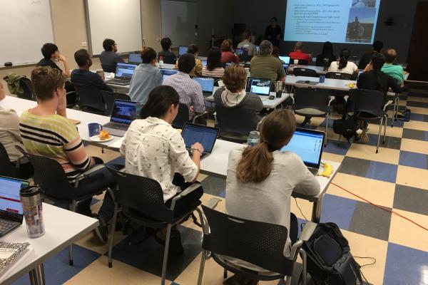
The workshop was run by Kaitlyn Harbeck, an ICESat-2 support scientist at NASA's Goddard Space Flight Center in Maryland. Kaitlyn is a former Ohio State student who studied with Dr. Ian Howat in the Glacier Dynamics group before starting at NASA. The workshop began with a presentation about the ICESat-2 and its mission, precision, and data. The ICESat-2 orbits 310 miles above Earth's surface at 4.3 miles per second, with a 92-degree orbital inclination. This leaves a small hole of missing data over the North and South poles. The satellite repeats the same flight path every 91 days, which allows scientists to track surface elevation changes that may take place. The ATLAS instrument uses photon pulses of green light to collect up to 580 gigabytes of surface data daily.
In order to access and use the data collected from ICESat-2 and ATLAS, participants in this workshop learned how to operate NASA's EarthData Search program. Users can navigate through the large ATLAS database by selecting the dates, processing level, and an area of interest using the online drawing and selection tools. The available data can then be downloaded and used for research purposes. Participants spent the remainder of the workshop learning how to incorporate the data into their own work before the workshop concluded.
The mission of the workshop was to introduce a new precise surface elevation dataset to interested students and faculty, and also provide tools for accessing and using the data. The applications for this information are endless and will be used by several BPCRC groups including glacier dynamics, the mountain drone team, ice core paleoclimatology, and more.
