The Study of Blowing Snow!
The Byrd Polar and Climate Research Center's Polar Meteorology Group at The Ohio State University is researching the impacts of blowing snow in the Northern Great Plains using novel instrumentation and coupled models. The National Science Foundation (NSF) funded this project which is a collaborative effort with Professor Aaron Kennedy at the University of North Dakota. The Ohio State's team is led by David Bromwich, research professor in the Department of Geography. The research aims to understand the physics behind the process of blowing snow, which affects visibility and safe travel as it is deposited in some areas and eroded in others, for example, where there are obstacles.
This research project uses satellite images and balloons to study blowing snow in a limited area of study. This phenomenon can typically be observed in the winter season, from November to March. The researchers process data and produce simulations of 1-2 blizzards with blowing snow and then use 10 National Weather Service (NWS) criteria to understand the characteristics of blowing snow.
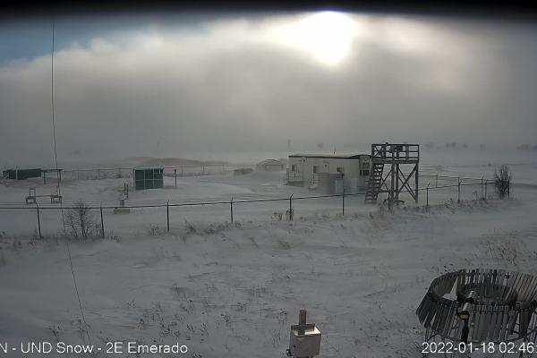
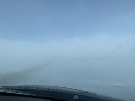
A blizzard is when the following conditions are expected to prevail for 3 hours or longer: sustained wind or frequent gusts to 35 miles an hour or greater and considerable falling and blowing snow with reduced visibility of less than ¼ mile.
As snow falls, sometimes as little as 10% is lost due to sublimation, by which it saturates the air. while the remaining 90% falls to the ground. Blowing snow is snow lifted from the surface by the wind at eye level, approximately 1.8 meters or 6 feet or more, which will reduce visibility. Blowing snow can come from falling snow or snow that already accumulated on the ground but is picked up and blown about by strong winds. It is one of the classic requirements for a blizzard.
The research team uses radar, vertically soaring weather balloons, and instruments to measure the characteristics of blowing snow. The researchers also take measurements on the ground and through the atmosphere at heights ranging from 500m to 1800m. The study area covers the eastern half of North Dakota and the western half of Minnesota, which receives a lot of snow in the winter, especially blowing snow. In addition, cold air outbreaks usually occur in February in this region, as is the case on the East Coast in the North Atlantic during winter. The Coriolis effect is a fundamental aspect of this research project. The effect causes slope winds to move faster downslope in certain valleys.

The Ohio State modeling represents how well the researchers can simulate what the atmosphere does. The research team uses weather forecast models, such as the Polar Warf Model, to adapt models for blowing snow using code.
The motivation for this study comes from the impact of blowing snow in Antarctica. The project began March 1 and will continue through fiscal year 2023. You can also read more about this collaboration by visiting the University of North Dakota's publication, UND Today.
Image credits: Aaron Kennedy, Department of Atmospheric Sciences, University of North Dakota