Franz Josef Land, Russia
Project Overview | 1996
In 1996, a new, exciting deep ice drilling program will commence in the high Russian Arctic, on the summit of Kupol Vyetreniy (Windy Dome) on Graham Bell Island (81oN, 64oE). This ice dome has a very symmetrical shape, maximum ice thickness of about 500-550m, and a peak elevation of about 580m.
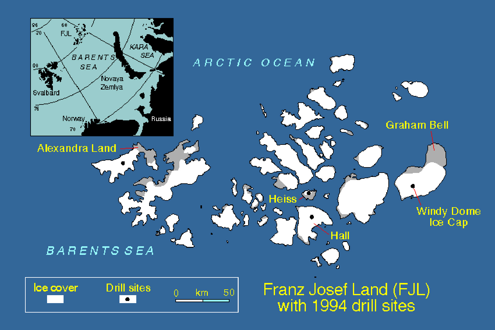
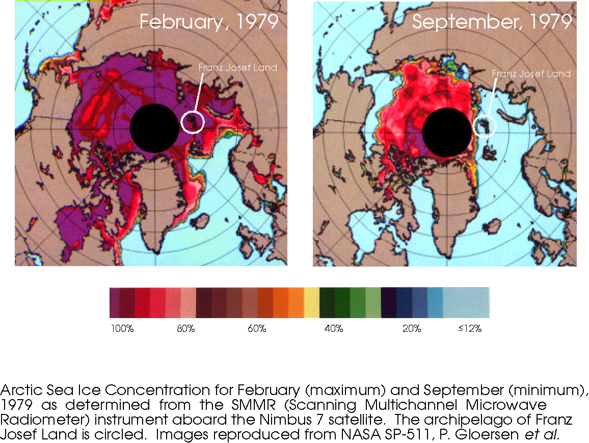
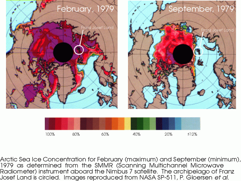
The archipelago of Franz Josef Land, on the northern rim of the continental shelf that underlies the Barents Sea, is the northernmost land mass in the Eastern Hemisphere. Here, the climate is influenced greatly by the intrusion of Atlantic-derived cyclonic systems that feed moisture into the region, and as a consequence, Franz Josef Land has unusually mild summers for its latitude. In the polar night (wintertime), however, the conditions become extremely harsh, with average temperatures diving down to -25 to -30oC. This means that Franz Josef Land is at a strategic location for studying changes in sea ice cover in the Arctic, since it lies in the region between the modern-day seasonal maximum (February) and minimum (September) sea ice cover. Satellite measurements of sea ice extent are being used in conjunction with stratigraphic profiles of sea-salt aerosols (Cl-, SO42-) from short cores (up to 24m) drilled in 1994 to develop a transfer function that will allow the ice core sea-salt record to be used as a proxy for changing sea ice cover in the surrounding Barents Sea.
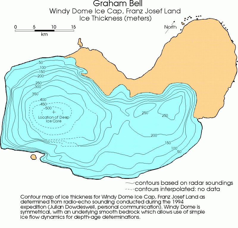
Windy Dome is likely to contain a record of local and regional conditions extending back to at least the early Holocene (8,000 to 10,000 years), and it is hoped that glacial stage ice is archived there as well. The 500m+ ice core (to bedrock) will be analyzed over the next few years following this upcoming field season. For this project, scientists from the Institute of Geography at the Russian Academy of Sciences (Moscow) will join researchers from the OSU Department of Geological Sciences and Byrd Polar Research Center. Funding is being provided by NASA.
Project Update | 1997
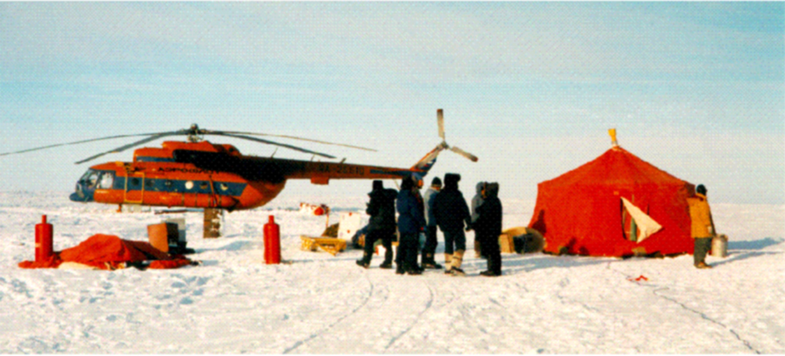
After a 1-year delay due to unavoidable logistical restraints, the ice core retrieval portion of this program was completed in April-May, 1997. Because Russian authorities would not allow foreign nationals onto Graham Bell Island, the field program was completed by an all-Russian party led by BPRC Research Associate Victor Zagorodnov. Our colleagues at the Institute of Geography, Russian Academy of Sciences (Moscow) conducted the drilling program (upper-left) and supplied the logistical support (upper-right).
The 10 cm-diameter thermal ice core drill Victor designed and built specifically for this project worked extremely well. Due to internal ice temperatures which were much colder than expected, the drilling team lacked a sufficient ethanol supply to continue drilling below 315 m. Still, the recovery and safe return of a deep ice core from Franz Josef Land is unprecedented, and will contribute greatly to our knowledge of the climatic history of the Barents Sea region over the last several thousand years. A second (36 m) core was also recovered and it will allow the determination of the annual dating of the record over the last 50 years. This ice will also provide samples for identifying well-known radioactivity horizons from nuclear bomb tests. Finally, snow pits were sampled at various locations on Windy Dome to study accumulation variations across the ice cap.
Following the compilation of a stratigraphic record from the 36 m core, we have already confirmed that the regular peaks in chloride ion (Cl-) concentration seen in the 1994 cores are indeed an annual signal of the migrating sea ice margin. Using these Cl- peaks as a dating tool, an accumulation rate between 400 and 700 mm (H2O eq.) was determined for the uppermost 15 years. Matching the stratigraphy between the 1994 and 1997 cores indicates that ~3.75 m of snow/firn has accumulated in the three intervening years. Since the firn density is roughly 0.5 g cm-3, this yields an average accumulation rate of ~600 mm (H2O eq.) in close agreement with our data obtained in 1994.
Englacial temperatures measured in the main borehole indicate a reverse temperature gradient (ice becomes colder with depth) down to ~250 m, where the minimum temperature (-11.3 °C) is reached. Similar profiles have been seen in other Eurasian Arctic glaciers, such as those in Svalbard (Austfonna) and Severnaya Zemlya (Academy of Science Glacier), where minimum temperatures were recorded at ~160 m. In each case, the climatic warming (and related increase in surface melting) of the past 150 years is responsible for the unusual borehole gradients. However, the indication from Franz Josef Land is that warming possibly began over 100 years earlier than at the other far northern sites.
Within the next year, complete profiles of ion chemistry, oxygen isotopic composition, microparticle concentrations, and size distributions will be completed on the 315 m ice core. As the analyses progress, annual peaks in Cl- (and perhaps other parameters) will be counted to determine the age of the bottom ice. Event horizons (e.g., nuclear tests, volcanic eruptions) will be sought to confirm the dating. Once the complete paleoclimatic record has been produced, the interpretation phase will begin.
As the basis for his Ph.D. dissertation, BPRC Graduate Fellow Keith Henderson will be producing a long-term record of sea ice variability in this region using the anion chemistry (Cl-, SO42-) as a proxy. To develop the 'transfer function', he will investigate the relationship between ice core chemistry and observations of sea ice extent from satellites, ground stations, and ships over the last 100 years or so. In situ climate data obtained from the Windy Dome automatic weather station, provided by colleagues at UMass, will also help interpret the recent record.
The Franz Josef Land program is supported by grants from NASA's Polar Research Program and their Earth System Science Fellowship program.
