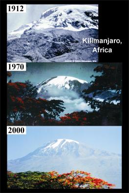
Mt. Kilimanjaro, Tanzania (2000)
Project Overview
This project was funded by the National Science Foundation's Earth System History Program (ATM-9910172).
The Kilimanjaro ice cores provide a nearly continuous, high-resolution record of Holocene climate conditions for the last ~11.7 ka. Isotopic enrichment (suggesting warmer conditions) and reduced concentrations of major aerosol species such as Mg2+, Ca2+, SO42-, and NO3-(suggesting wetter conditions) dominate from ~11 to 4 ka. These data indicate that the ice fields formed during the well-documented African Humid Period when warmer and wetter conditions prevailed in response to the precession-driven increase in solar radiation. During this time interval, lakes in the region rose as much as 100 meters above their present levels and in sub-Saharan Africa lake expansion was spectacular with Lake Chad expanding 25-fold from ~17,000 km2 to cover an area between ~330,000 and 438,000 km2, comparable to that of the Caspian Sea today. After ~4 ka BP African lake levels dropped as conditions became cooler (more depleted δ18O) and drier (higher concentrations of the major aerosol species). The Kilimanjaro records capture the major African climate trends during the Holocene, as well as the larger scale trends in tropical temperature as inferred from their similarity to the Huascarán δ18O and dust records.
Key paper:
Thompson, L. G., E. Mosley-Thompson, M. E. Davis, K. A. Henderson, H. H. Brecher,V.S. Zagorodnov, T. A. Mashiotta, P-N. Lin, V. N. Mikhalenko, D. R. Hardy and J. Beer, Kilimanjaro ice core records: Evidence of Holocene climate change in tropical Africa, Science, 298, 589-593, 2002.
Ice Core Recovery
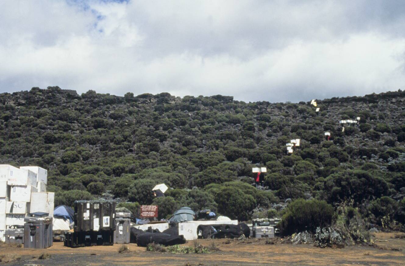
In January and February of 2000, six ice cores were drilled to bedrock from the three remnant ice fields on the rim and summit plateau atop Kilimanjaro (3° 03.7' S; 37° 21.2' E; 5893 m asl). The three longest cores (NIF1, NIF2, NIF3) were drilled to depths of 50.9, 50.8, and 49.0 meters, respectively, from the Northern Ice Field (NIF), the largest of the ice bodies. The photo to the left shows the OSU drill camp (dome on top of the NIF) and the field camp that appears as small specks just in front of the NIF wall. A closer view of the field camp is shown below.
Two shorter cores (SIF1 and SIF2) were drilled to bedrock on the Southern Ice Field (SIF) to depths of 18.5 m and 22.3 m, respectively, and a 9.5-m core (FWG) was drilled to bedrock on the small, thin Furtwängler Glacier (FWG) within the crater. Temperatures were measured in each borehole and ranged from -1.2°C at 10 meters depth to -0.4°C at bedrock in the NIF and were consistently near 0°C in the SIF. No evidence of water was observed in the boreholes on the NIF and SIF, but the Furtwängler Glacier (FWG) was water saturated throughout so that the FWG core was recovered from a water-filled borehole.
Ice Core Analyses
Six ice cores were transported frozen to the cold rooms at The Ohio State University (OSU) where the entire lengths of five cores were cut into a continuous sequence of samples (NIF2, 2197 samples; NIF3, 1980 samples; SIF1, 706 samples; SIF2, 834 samples; FWG, 343 samples).
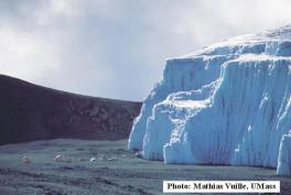
The figure (left) shows the 11.7 ka Kilimanjaro record of dust concentration and δ18O along with other key climate histories in the region. See the key paper for detailed discussion. These cores were were analyzed for oxygen and hydrogen isotopic ratios (δ18O, δD), concentrations of insoluble microparticles (dust), major anions (fluoride, chloride, nitrate and sulfate) and major cations (sodium, ammonium, potassium, magnesium and calcium). NIF1 (drilled one meter from NIF2) has been reserved for other measurements including AMS 14C and pollen. The large dust visible dust layer (far left photo) occurs at ~4,200 years B.P. (highlighted in the figire) and represents a nearly 300 year long drought in the region.
Available Data
NGDC News Story (2002):
Kilimanjaro Ice Core Records: Evidence of Holocene Climate Change in Tropical Africa
CNN/TIME News Story (2001):
Deciphering the ice: Scientist drills into tropical glaciers for clues to Earth's climate changes
Available Data:
Kilimanjaro (TZA; 3S,37E)
Oxygen Isotope, Ion, and Dust Data and Description (Thompson,L.G.)
World Data Center for Paleoclimatology Mirror (Ice Core Gateway):
Field Logistics
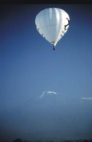
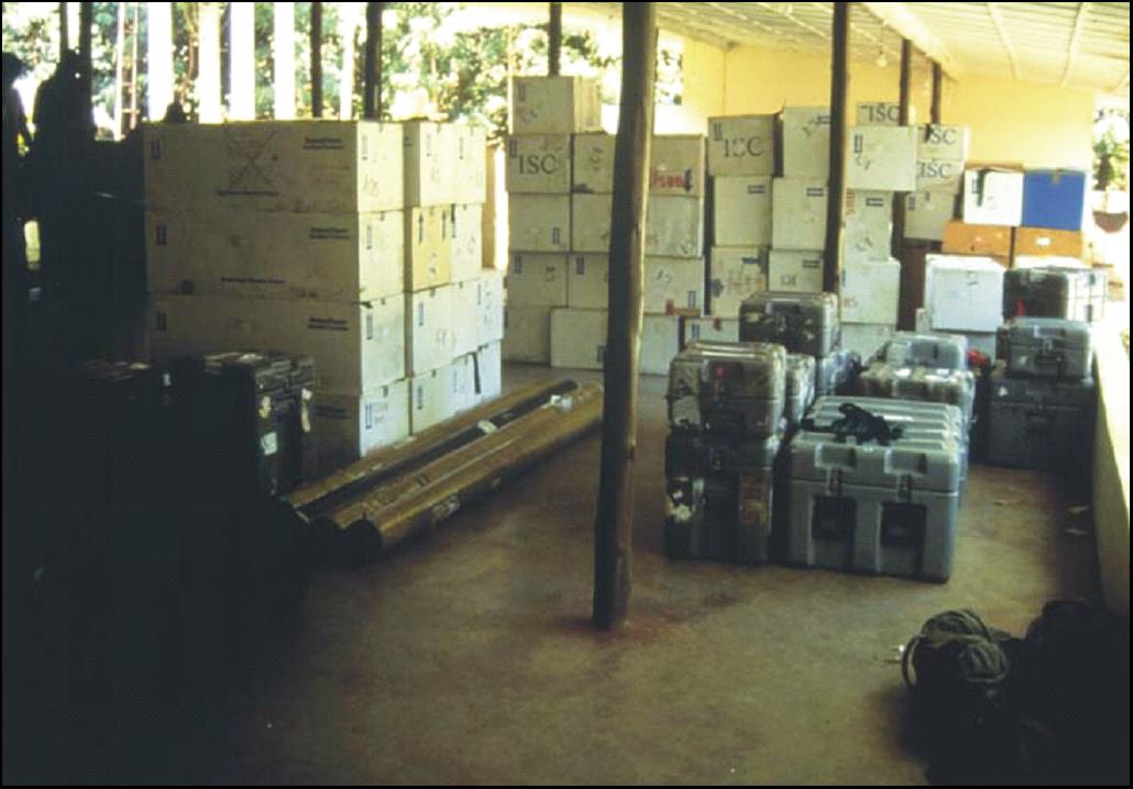
There were many challenges that had to be met for the successful completion of this project. We had to acquire 25 permits from 7 different agencies. Unfortunately we did not get a permit from the park warden to transport the ice core from the summit using our hot air balloon, the Soaring Penguin (left), that has been designed specifically for this purpose. Thus, we purchased a 20 ft storage freezer, had its compressors overhauled and positioned it on the Simba Farm at the base of Kilimanjaro. We hired over 90 porters (upper right photo) to transport the ice core in insulated containers (right) from the drill site down to the storage freezer where it awaited shipment back to freezers at The Ohio State University.
The Ice Core Drill
A light-weight, portable drilling system designed for coring to a depth of up to 700 meters was developed and tested by Victor Zagorodnov at OSU’s Byrd Polar Research Center (BPRC) for this project. The OSU system is designed to be quickly switched from a dry hole electro-mechanical drill (used to 180 meters) to a thermal-alcohol electric drill. The drill was powered using a combination of solar and diesel generators. The system is powered with a light-weight, highly fuel efficient diesel generator that minimizes environmental impact This lightweight system makes ice core drilling more cost efficient by reducing logistical requirements to bring it to the drill site. Both drills (electro-mechanical and thermal) produce 100-mm diameter core sections up to 2.1 meters long. A newly developed, quick assembly geodesic dome, designed and built at OSU, houses all drilling and core processing activities. These photos show the drill set up under this dome on Kilimanjaro. The photo to the left shows Victor Zagorodnov (right) and Vladimir Mikhalenko (left) operating the drill. The photo below shows the winch and cable, the controller units, the outer barrel resting horizontally in the tilting tray and the inner barrel (background) that is being prepared for the next ice core recovery run.
Glacier Retreat
This document accompanies the paper by Thompson et al. published November 3, 2009 in PNAS. The supplemental text on the PNAS web site indicated that additional information would be provided here. This addendum includes (1) a detailed discussion of each domain and its ice entities present in the different aerial photographs and (2) additional examples of the interpretative discrepancies between the areal coverage determinations by Cullen et al. (2003) and Thompson et al. (2002). Addendum
The discussion below reflects the new information published in our 2009 PNAS paper (10.1073/pnas.0909029106):
Thompson, L.G., H.H. Brecher, E. Mosley-Thompson, D.R. Hardy, and B.G. Mark. 2009. Glacier loss on Kilimanjaro continues unabated. Proceedings of the National Academy of Sciences, doi:10.1073/pnas.0906029106. PDF and Supplement
An aerial photograph taken on October 15, 2007 (below) was used to produce a current, detailed map of ice cover extent on the summit plateau. The compilation of six maps (lower right) of ice extent since 1912, the first four of which were assembled by Hastenrath and Greischar (J. Glaciology, 43, 1997), demonstrates a sustained loss of ice on Kilimanjaro over the last century. The three remaining ice fields on the plateau and on the slopes are both shrinking laterally and rapidly thinning. Summit ice cover (areal extent) decreased ~1% per year from 1912 to 1953 and ~2.5% per year from 1989 to 2007. Of the ice cover present in 1912, 85% has disappeared and 26% of that present in 2000 is now gone. From 2000 to 2007 thinning (surface lowering) at the summits of the Northern and Southern Ice Fields was ~1.9 and 5.1 m, respectively, which based on ice thicknesses at the summit drill sites in 2000 represents a thinning of ~3.6% and 24%, respectively. Furtwängler Glacier thinned ~50% at the drill site between 2000 and 2009. Ice volume changes (2000 - 2007) calculated for two ice fields reveal that nearly-equivalent ice volumes are now being lost to thinning and lateral shrinking.
The relative importance of different climatological drivers remains an area of active inquiry, yet several points bear consideration. Kilimanjaro’s ice loss is contemporaneous with widespread glacier retreat in mid- to low-latitudes. The NIF has persisted at least 11,700 years and survived a widespread drought ~4,200 years ago that lasted ~300 years. We present additional evidence that the combination of processes driving the current shrinking and thinning of Kilimanjaro’s ice fields is unique within an 11,700 year perspective. If current climatological conditions are sustained, the ice fields atop Kilimanjaro and on its flanks will likely disappear within several decades.
Ancillary Studies
No routine meteorological observations have been made on Kilimanjaro prior to this project . Therefore, concurrent with the February 2000 drilling program, colleagues Raymond Bradley and Doug Hardy (Univ. Massachusetts) established an automatic weather station (AWS) at the NIF2 drill site (5794 m a.s.l.; 506 hPa) to continuously measure aspirated air temperature and humidity, incoming solar radiation, wind speed and direction, barometric pressure, and changes in the surface height by either accumulation or ablation. The AWS is shown below. Details are available from the UMass Department of Earth, Geographic and Climate Sciences website.