Huascarán
Peru
Overview (1993)
 18O and D.
The following paper (abstract is clickable) summarizes the results from the Huascaran cores.
Thompson, L.G., E. Mosley-Thompson, M.E. Davis, P-N. Lin, K.A. Henderson, J. Cole-Dai, J.F. Bolzan and K-b. Liu. 1995. Late Glacial Stage and Holocene tropical ice core records from Huascarán, Peru. Science, 269, 46-50.
Overview (2019)
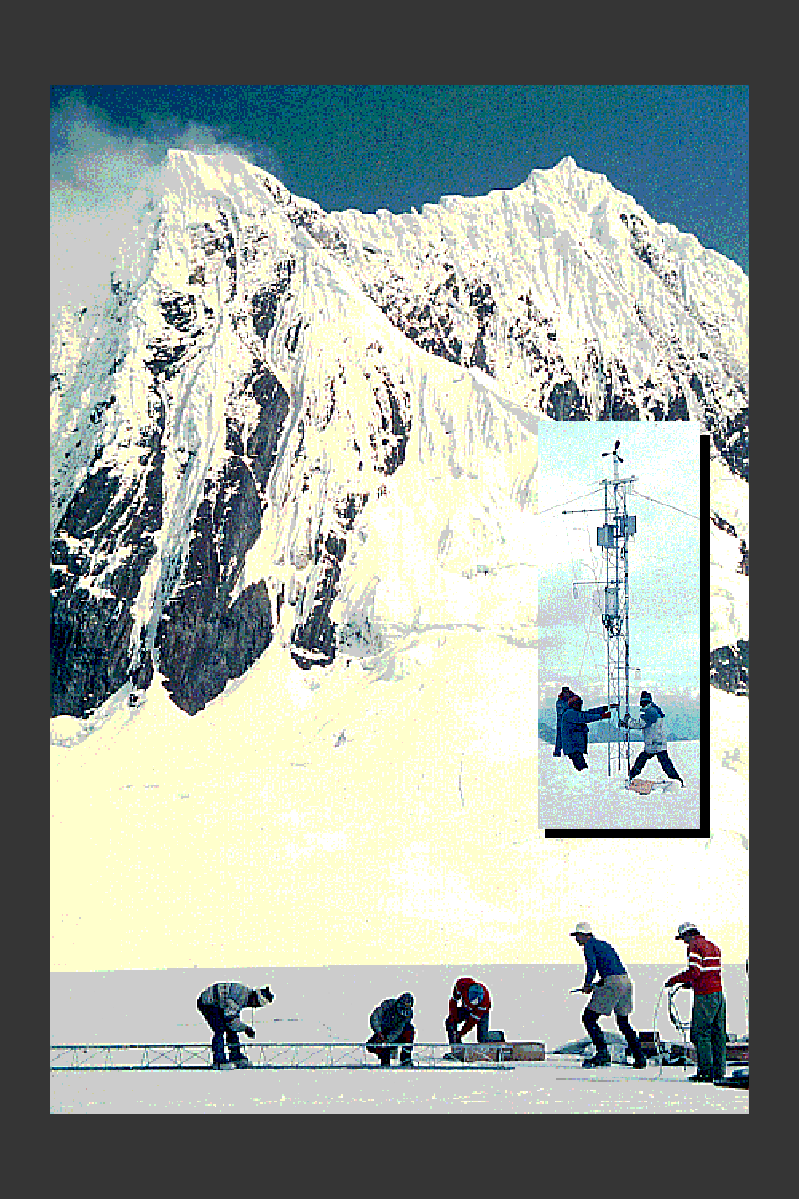
During a reconnaissance mission to Nevado Huascarán in July 2016, researchers from the Byrd Polar and Climate Research Center recovered a 10.9 m firn core from the mountain’s col (6050 m above sea level). Subsequent laboratory measurements showed that, unlike other tropical ice cores from Peru, the seasonal δ18O profile at Huascarán remains undisturbed [Thompson et al. 2017].
In August 2019, researchers returned to Huascarán to drill the first ice cores to bedrock since the original campaign in 1993 [Thompson et al. 2023]. This included two cores from the mountain col (Col Core A and Col Core B) that measured 165.0 m and 168.6 m in length, respectively, as well as the first-ever cores drilled form the mountain summit (6768 m above sea level). The summit cores (Summit Core A and Summit Core B) measured 69.3 m and 68.7 m in length, respectively. To date, these are the highest-elevation ice core records ever obtained from the tropics. Annually-resolved oxygen stable isotope (δ18O) and net accumulation records have since been reported for the col and summit cores that extend through the most recent six decades [Weber et al. 2023]. Preliminary black carbon measurements have also been reported [Bonilla et al. 2023].
References
Bonilla, E. X., Mickley, L. J., Beaudon, E. G., Thompson, L. G., Rodriguez, W. E., Encarnación, R. C., Whicker, C. A., Flanner, M. G., Schmitt, C. G., & Ginot, P. (2023). Contribution of biomass burning to black carbon deposition on Andean glaciers: Consequences for radiative forcing. Environmental Research Letters, 18(2), 024031. DOI: 10.1088/1748-9326/acb371
Thompson, L. G., Davis, M. E., Mosley‐Thompson, E., Beaudon, E., Porter, S. E., Kutuzov, S., Lin, P. ‐N., Mikhalenko, V. N., & Mountain, K. R. (2017). Impacts of Recent Warming and the 2015/2016 El Niño on Tropical Peruvian Ice Fields. Journal of Geophysical Research: Atmospheres, 122(23). DOI: 10.1002/2017JD026592
Thompson, L. G., Mosley-Thompson, E., Schoessow, F., Davis, M. E., Sierra-Hernandez, R., Beaudon, E., & the Huascarán team. (2023). The challenges, successes, and preliminary status report on the 2019 recovery of ice cores from Nevado Huascarán, Earth’s highest tropical mountain. Revista de Glaciares y Ecosistemas de Montaña, 8, 31-42. PDF
Weber, A. M., Thompson, L. G., Davis, M., Mosley-Thompson, E., Beaudon, E., Kenny, D., Lin, P.-N., & Sierra-Hernández, R. (2023). Drivers of δ18O Variability Preserved in Ice Cores From Earth’s Highest Tropical Mountain. Journal of Geophysical Research: Atmospheres, 128(19), e2023JD039006. DOI: 10.1088/1748-9326/acb371