Bona-Churchill, Alaska (2002)
Ice core reconstruction of North Pacific climate variability and environmental history from the Bona-Churchill Ice Field, Alaska. This project is funded by the National Science Foundation's Office of Polar Programs (OPP-0099311) and is in its third year.
This project was designed to retrieve and analyze ice cores from the col situated between Mt. Bona and Mt. Churchill (61o 24' N, 141o 42' W; 4420 m asl) in Wrangell-St Elias Mountains of southeastern Alaska. These records will fill a significant void in the high resolution climate history of this region. These new ice core records will complement and extend the existing tree ring-based climate records for the region and will add to the suite of high resolution ice core histories now emerging from other north polar ice fields. Global scale syntheses of past climate variability include ice core contributions from both Antarctica and Greenland as well as from ten lower latitude, high altitude sites in Tibet, South America and Africa. To date the unique paleohistories preserved in Alaska's ice fields have not been tapped and thus have not contributed to this global climate synthesis. The sparseness of high resolution climate histories from the northeastern side of the Pacific Basin has been a major obstacle to advancing our understanding of the rapid and recent changes in the dynamical state of the Pacific region and its global teleconnections. The ice cores attained from the Bona-Churchill col will help fill this void and provide critical new insight to the climate history in this region.
Our scientific objectives for the Bona-Churchill cores include:
- Assess whether the warming of the last 30 years that appears to be amplified at high elevations in the tropics and subtropics extends to northwestern North America;
- Assess the character of the most recent 'step' change in the dynamics of the Pacific Basin climate regime that occurred in 1976-77 and explore whether similar abrupt transitions have occurred in the past and if so, determine when and of what magnitude were the changes;
- Explore whether the recently identified multi-decadal ENSO-like mid-latitude climate variability has its roots in the tropical Pacific;
- Determine the bottom age of the ice on Bona-Churchill col; and
- Determine whether Mt. Churchill is indeed the source of the White River Ash.
The topics to the right provide more specific information about the various aspects of the project and selected photographs.
Ice Core Recovery
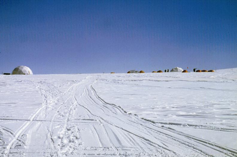
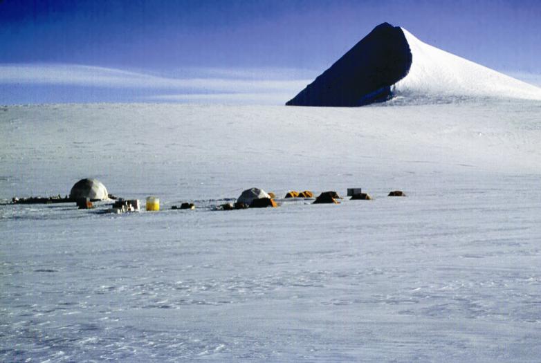
Six cores, totaling 623 meters, were drilled at the sites shown in the figure. Core 1, the longest, was drilled 460 meters to bedrock. This is the deepest ice core to be recovered from an alpine ice field. The 10-meter ice temperature was -24o C and the temperature at 460 meters was -19.8oC; therefore, the col of Bona-Churchill is a cold based glacier. Core 2 was 114 meters long and was complemented by four shallow cores ranging from 10 to 12 meters in length. These were drilled in a diamond-shaped configuration across the col. The short cores were recovered to determine the impact of drifting on the various chemical and physical signals preserved in the ice strata and to assess the reproducibility of the records from the col. These shallow cores, along with the two deep cores, will allow characterization of the spatial distribution of annual snow accumulation (An) across the col. A single pulse radar-sounding unit was used to measure bedrock depths at 34 sites across the col, and these data were used to prepare an ice thickness map. The surface was mapped using GPS and an electronic altimeter.
Ice Core Analyses
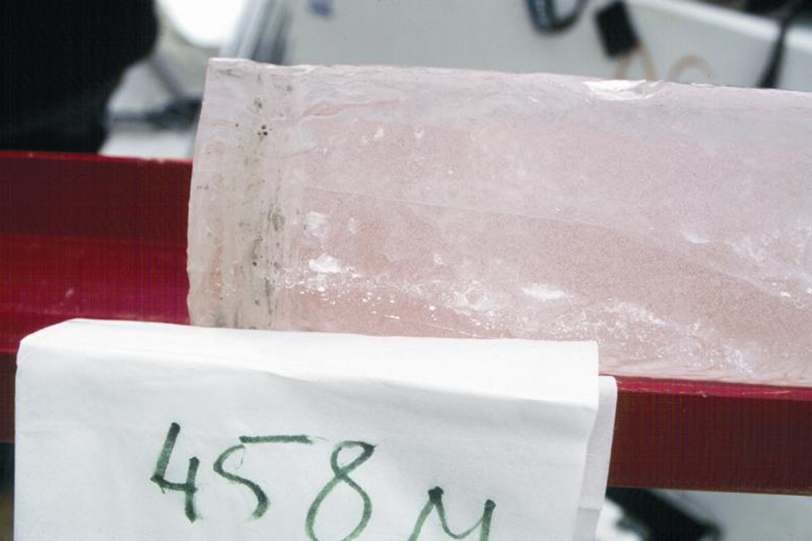
The analyses of the Bona-Churchill ice cores are now underway in the laboratories at OSU's BPRC. The primary measurements that are being made continuously along the length of all cores include the concentration and size distribution of insoluble microparticles (dust), δ18O, δD, and concentrations of the major anion and cation species. The upper sections of the cores have been analyzed for total Beta radioactivity. The annual accumulation rate has averaged ~1100 mm of water equivalent over the recent past. As of October 2003 we have analyzed 5600 δ18O, δD, dust and chemistry samples representing 320 meters of the 460-meter deep ice core. The dust and calcium concentrations show distinct annual variations and the preliminary results suggest that the annually resolved record will cover more than 2500 years. This bodes well for the recovery of a very high-resolution record of past climatic and environmental variability from these cores.
In November 2003 David Urmann, a graduate student in the Department of Geological Sciences, will complete his Master's thesis entitled: 'An Evaluation and comparison of ice core data from Bona-Churchill and Quelccaya, and lake level data for the Western United States, Alaska and Peru as proxies of El Niño events during the last one hundred years.'
Field Logistics
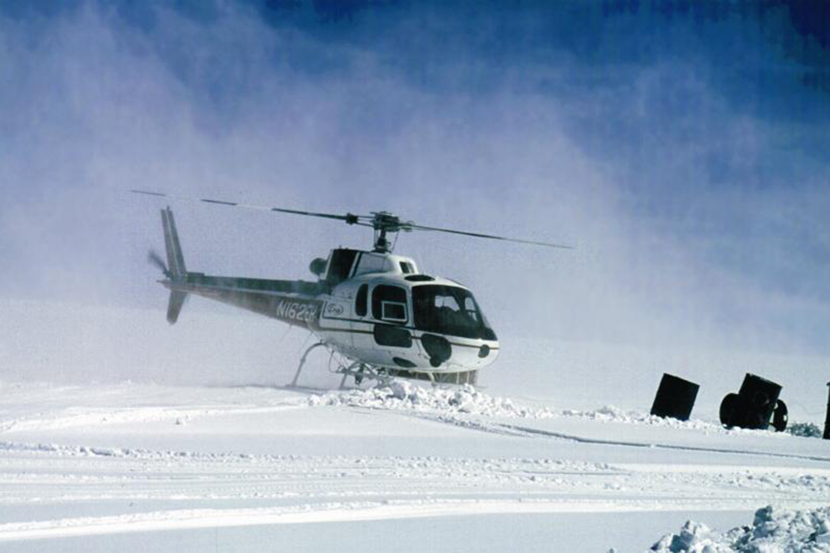
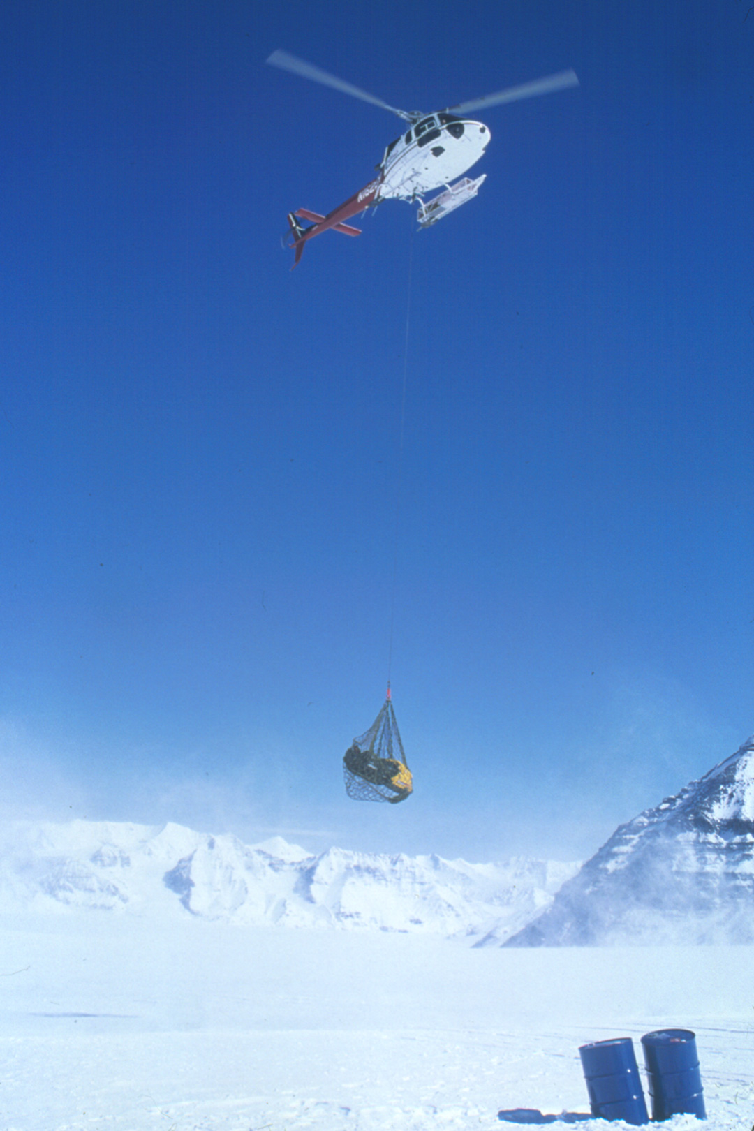
From April 30th to June 10th, 2002 a deep drilling program was conducted on the col of Bona-Churchill in southeastern Alaska. This was the critical meteorological window when weather conditions were the best for aircraft operations and temperatures were still sufficiently cold at the col to drill the ice cores and store them for retrograde. The field operations were supported by an AS350 helicopter (photo below) that was piloted by Lambert DeGavere, under contract from ERA Aviation, and an Otter (photo below) piloted by Paul Klaus of Ultimate Thule Outfitters. VECO, under contract to NSF, provided the logistical support including air support.
The Ice Core Drill
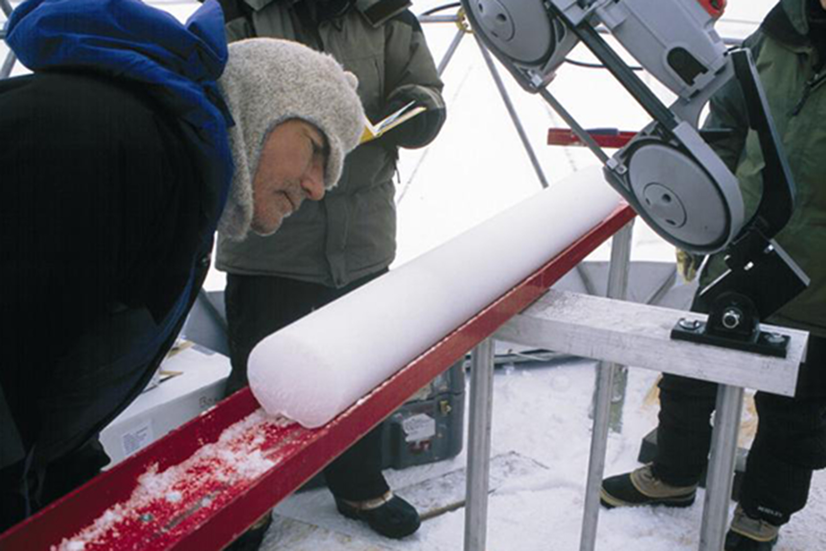
A light-weight, portable drilling system designed for coring to a depth of up to 700 meters was developed and tested by Victor Zagorodnov at OSU's Byrd Polar Research Center (BPRC) for this project. The drill system included a complete setup with a 700-m cable capacity and a controller unit. Due to the thickness of the Bona-Churchill ice field it was necessary to use multiple drilling technologies. The OSU system is designed to be quickly switched from a dry hole electro-mechanical drill (used to 180 meters) to a thermal-alcohol electric drill that collected core from 180 to 460 meters. The core quality ranged from good to excellent. The system is powered with a light-weight, highly fuel efficient diesel generator that minimized environmental impact on the col. This lightweight system made ice core drilling on this project more cost efficient by reducing airlift requirements. Both drills (electro-mechanical and thermal) produce 100-mm diameter core sections up to 2.1 meters long. A newly developed, quick assembly geodesic dome, designed and built at OSU, housed all drilling and core processing activities.
Glacial Geology
In addition to the ice core drilling program, a small glacial geology team collected samples along the terminus of the glaciers that flow from Mt. Bona and Mt. Churchill. The goal is to date the previous advances and retreats of this ice field. This small project has already resulted in a successfully defended Master's Thesis by Amanda Cavin, a graduate student in the Department of Geological Sciences who collected samples during the 2002 field season. Her thesis is entitled: 'Climate and Glacier Change in South Central Alaska from Radiocarbon Dates, Paleoclimate Records, and Landsat-7 Data.'