China
Overview
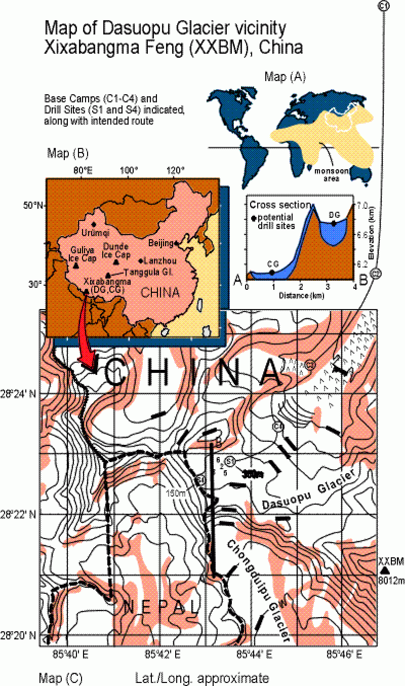
The Qinghai-Tibetan Plateau, one of the most imposing topographic features on the Earth's surface, has a mean elevation of ~5 km and comprises an area half that of the United States. Sensible heat flux and the latent heat release over the Q-T Plateau drives the regionally intense monsoon circulation and strongly influences global circulation patterns. Reliable meteorological observations are largely absent from this region. Ice sheets and ice caps serve as libraries of atmospheric history from which past climatic and environmental conditions may be extrapolated. Glaciers occur at high elevations on the Q-T Plateau and cover an area of ~57,000 km2 and thus judiciously selected ice caps provide the potential to develop a spatially coherent climate history for the region. Our Chinese projects on Dasuopu, Dunde and Guliya (see map) are described briefly. The paper below compares high resolution ice core records from the Dunde Ice Cap on the northeastern margin of the Q-T Plateau and the Guliya Ice Cap on the far western margin.
Thompson, L.G. 1996. Climatic changes for the last 2000 years inferred from ice-core evidence in tropical ice cores. In: Climatic Variations and Forcing Mechanisms of the Last 2,000 Years, P.D. Jones, R. Bradley and J. Jouzel, editors. NATO Advanced Research Series I, 41, 281-295. PDF