Dasuopu
China
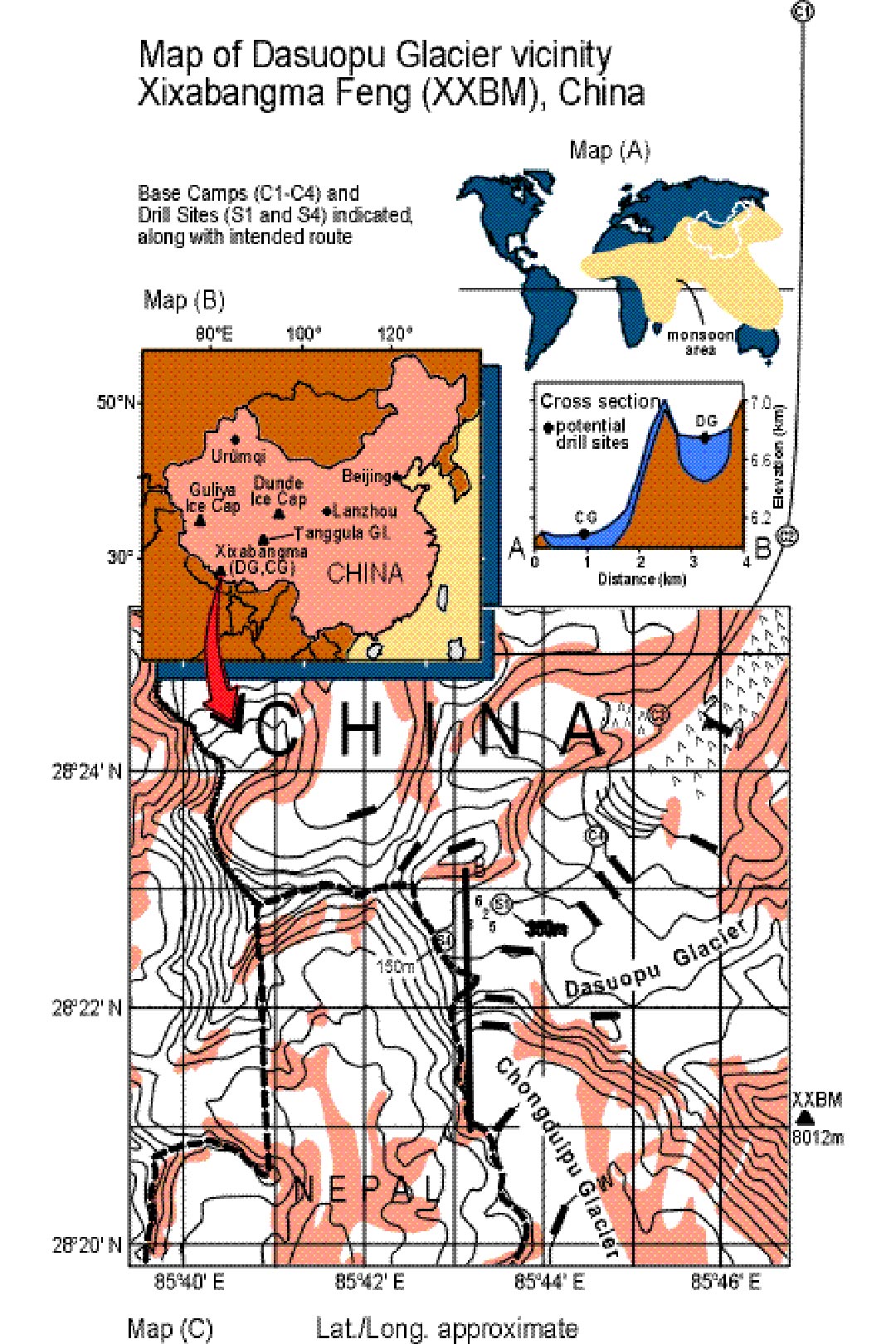
Project Overview
On the south central rim of the Tibetan Plateau, the highest and largest plateau in the world, Dasuopu (28oN 85oE, 6900 m) will fill a gap in paleoclimate records and become part of the Austral-Asian transect in an international project under Past Global Changes (PAGES) Pole Equator Pole (PEP) II Program. This project will attempt to recover the highest ice core ever drilled. The Dasuopu core will complement ice cores previously drilled from ice caps on the northeastern (Dunde) and northwestern (Guliya) margins of the Tibetan plateau. These projects are described below.
The Asian monsoon influences the most heavily populated region in the world and is recognized as a significant component of the global atmospheric circulation. Dasuopu is well within the monsoonal airflow and should have annually recognizable wet to dry season layers in both oxygen isotopic ratio and dust. Yearly resolution is expected for the last 1000 to 3000 years. Decadal resolution is expected for the remainder of the core. Since the Asian monsoons are related to the El Niño-Southern Oscillation (ENSO), this core should add to the knowledge of ENSO variability and its connections to other parts of the world.
Scientists from the Lanzhou Institute of Glaciology and Geocryology, China will join The Ohio State University's Department of Geological Sciences and Byrd Polar Research Center in this three part project. Each part will take approximately one year. The initial field work will include short pulse radar, pit sampling, and accumulation/strain network which will better assess the likelihood of this col containing high resolution, well-preserved ice records. The following year will include drilling a core to bedrock and borehole temperature measurements. Finally, the field work will be followed up by laboratory analyses of the ice and data interpretation. An alternative site, Chongduipu, is located next to Dasuopu. This project is funded by the National Science Foundation.
Project Update
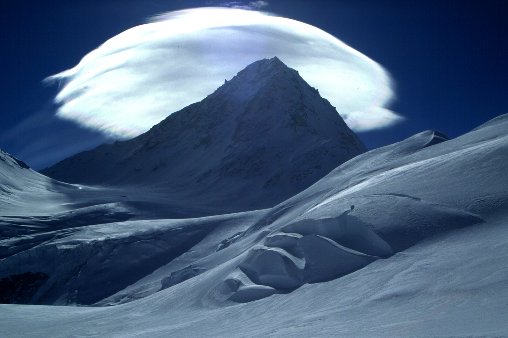
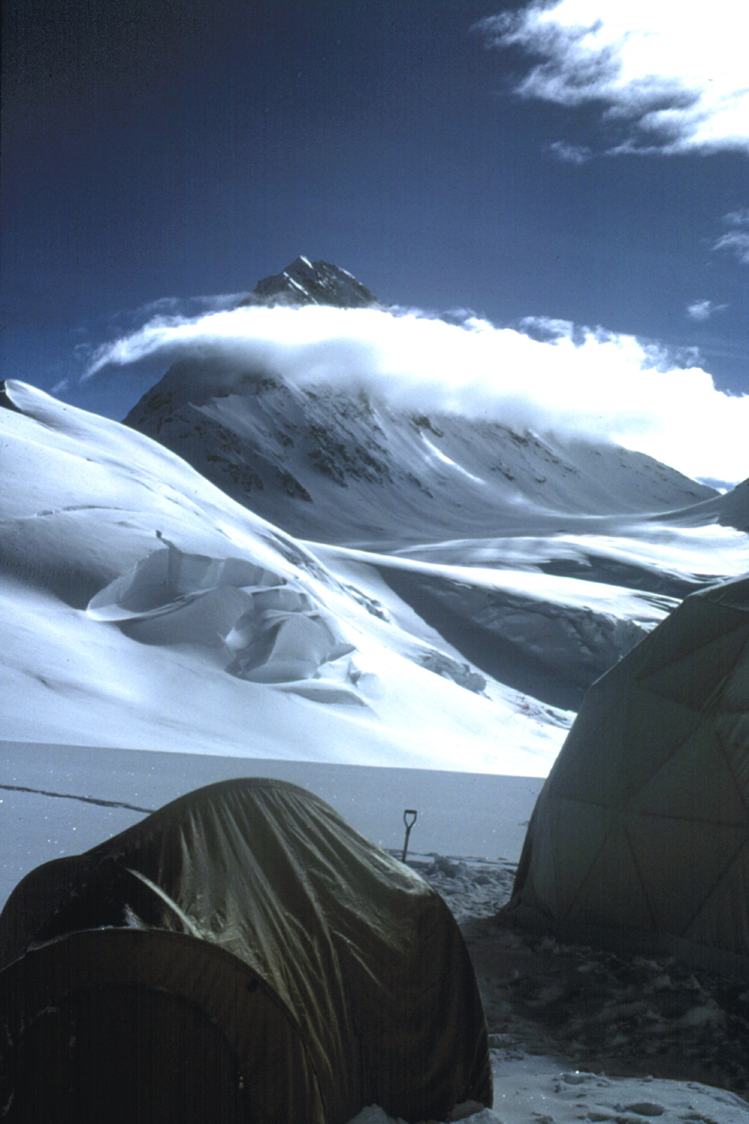
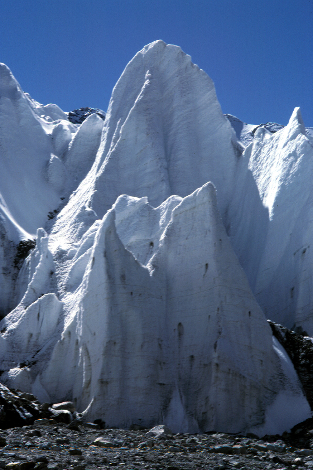
The 1996 Dasuopu reconnaissance field program was very successful. Several snowpits were sampled and two 20-m cores were recovered from different sites on the relatively flat portion of the Dasuopu Glacier at an elevation on of nearly 7000 m (~23,000 feet). The outlet glacier from Dasuopu is characterized by a large field of 'penitente', ice pinnacles carved by wasting due to the overhead sun (photo to left), which pose difficulties in reaching the drill sites. The atmosphere at the upper reaches of Dasuopu Glacier is very thin and cold; 10-meter borehole temperatures averaged about - 13°C. Core quality was very good, and the chemical records from each core display very distinct seasonal variations in virtually every parameter (dust, isotopes, major anions).
Roughly 15 years of archive were recovered in each core, yielding an average accumulation rate of ~0.85 m (H2O eq.) per year. Average δ18O values were about -18%o, with a seasonal range of about 10%o or more. As in many tropical and subtropical locations, the more isotopically-depleted snowfall occurs in the summer due to the strong removal of the heavier isotope during the intense monsoon rains over India and Nepal. On an interannual scale, a strong relationship between annual average δ18O and accumulation is evident, with the thick layers of the mid-1980's coinciding with more negative δ18O. In the 1990's, enriched isotopes are coupled with decreased accumulation. The results from the 1996 field expedition reaffirm our speculation that this site has a high probability of producing a very well preserved and long paleoclimate record. At this time the OSU field team is enroute to Dasuopu for the August-October drilling project.
Single-pulse radar soundings of the Dasuopu Glacier indicate that the ice thicknesses at the two potential drill sites (S1 and S4, as indicated on map) are ~350 m and ~150 m, respectively. For the upcoming 1997 deep ice core drilling field program, the primary goal will be to recover a core to bedrock at Site 1, and return it frozen to BPRC. The 'col' site (Site 4) will be the secondary site, and the decision to return that core frozen (vs. melting and bottling samples in the field) will be made on site.
Because the surrounding terrain is mainly snow- or ice-covered, traditional surveying techniques proved inadequate for geolocation of a stake network and thus also for detecting glacier movement. Therefore, we will be attempting to measure ice velocities and determine strain rates of the Dasuopu Glacier by use of geodetic GPS receivers. These devices (Trimble 4000SST receivers) are kindly being provided by UNAVCO at UCAR. Highly accurate positions of each stake in a network across the glacier will be obtained at the beginning and end of the drilling program (roughly 5-6 weeks duration). Ice velocities and flow directions will be determined by the change in position over the elapsed time.
This project is funded by the Office of Climate Dynamics of the National Science Foundation. Our colleagues at the Lanzhou Institute of Glaciology and Geocryology (under the direction of Dr. Tandong Yao) are co-investigators in this research, and are funded by the National Natural Science Foundation of China.