News
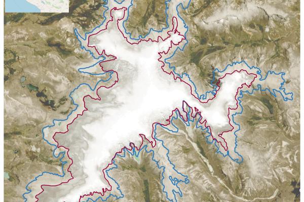
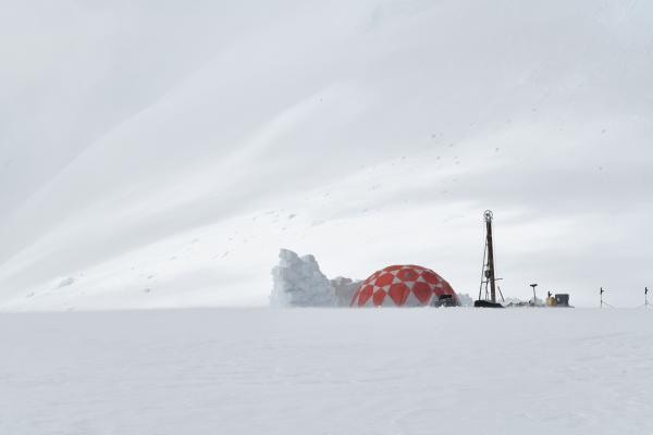
Reconstructing the Quelccaya Ice Cap's Holocene Evolution Through Radiocarbon-Dated Plant Remains
The Quelccaya Ice Cap (QIC) in Peru, recognized as one of the world's largest tropical ice caps, has been the focus of extensive research, particularly in studying its fluctuations during the…
Three New Faculty to Join the Byrd Center in 2024!
The Byrd Center is pleased to announce that three new Byrd-affiliated faculty members in the School of Earth Sciences (SES) will start in January 2024! A warm welcome to Emilie Beaudon, Melisa…
AI Mapping Reveals Potential Subsurface Natural Hydrogen Worldwide
Byrd Center researchers at The Ohio State University have developed a deep-learning model to identify surface features associated with subsurface reservoirs of naturally occurring free hydrogen…
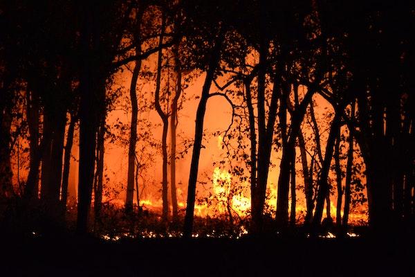
Revolutionizing Wildfire Management: SAR Technology Enhances Detection and Response
Researchers at The Ohio State University are advancing wildfire management by integrating remote sensing technology, specifically Synthetic Aperture Radar (SAR), for more effective detection and…
Oxygen-Stable Isotope Records from Tropical Mountain Ice Cores as a Goldilocks Indicator for Global Temperature Change
In a recent international collaboration, researchers at The Ohio State University's Byrd Polar and Climate Research Center analyzed ice samples from high tropical mountains to gain a unique…
The Impact of Mountains on El Niño-Induced Winter Precipitation in Western North America
A recent study highlighted by Ohio State News examined the impact of mountains on El Niño- and La Niña-induced precipitation changes in western North America. This study, backed by 150 years of…
Impacts and Sources of Black Carbon in the Arctic: Insights from a 300-Year Svalbard Ice Core Record
In a comprehensive study spanning 300 years (1700-2005) of an ice core from Svalbard in the European high Arctic, researchers examined the sources and characteristics of black carbon (BC)…
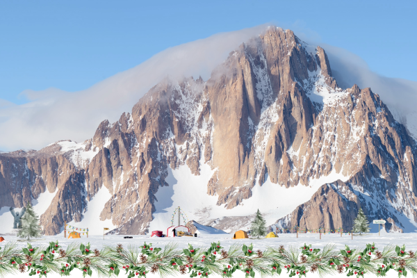
Frozen in Time: The Eternal Silence of Mt. Tidd in Antarctica's Pirrit Hills!
This year, to commemorate the Polar Rock Repository's 20th anniversary, we selected the image of Mt. Tidd in Antarctica's Pirrit Hills for our Season's Greetings. The image was contributed by…

Toracinta 2023 Competition Awardee Announced
Congratulations to Sara Johnson, a Ph.D. student in the Department of Geography at The Ohio State University, this year’s awardee of the Toracinta Graduate Scholarship in…